Thornbury

More homes and more opportunities.

Planning for thriving communities

About

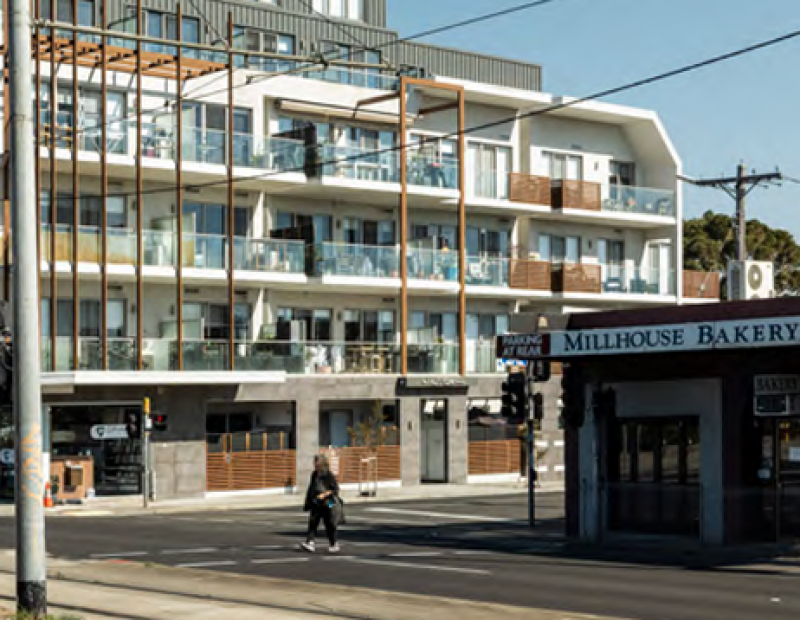
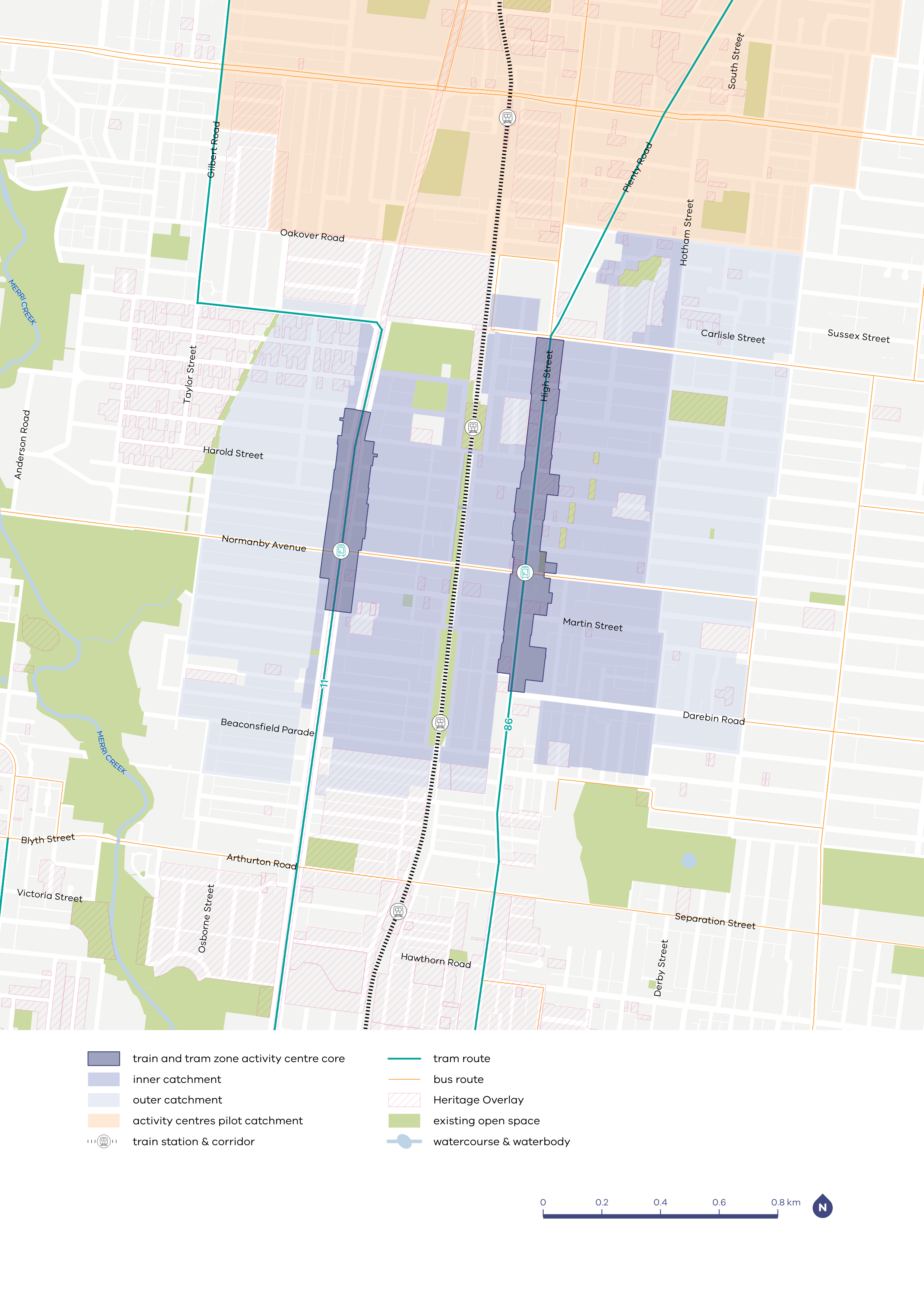
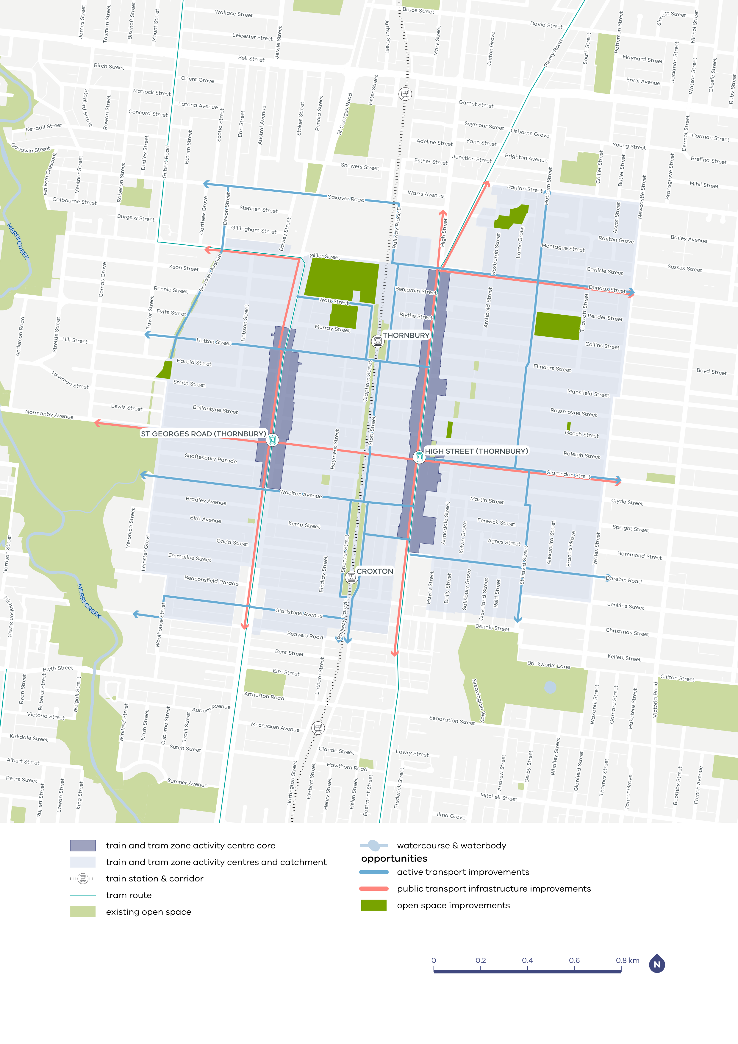
The Train and Tram Zone Activity Centres program is focused on locating more homes close to train stations and tram lines that have the highest capacity now and into the future. The High Street and St Georges Road activity centres in Thornbury benefit from excellent public transport connections and have capacity to accommodate more people close to existing train and tram services.

Plans for the Thornbury centres have been finalised and approved by the Minister for Planning, which means the planning changes are now in place.

The Thornbury and Croxton train stations on the Mernda line provide frequent rail services to the activity centres.

Recent level crossing removals and station upgrades at Bell and Preston enable efficient vehicle and pedestrian movements, while reducing road congestion, reconnecting communities, and improving safety. The project delivered open space and a new safer off‑road walking and cycling path from Oakover Road to Murray Road.

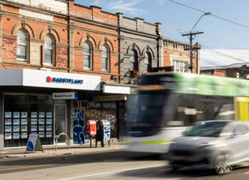
High Street and St Georges Road are serviced by high‑capacity low floor trams, and there is a strong network of buses in the area.

Trams provide a turn up and go high‑capacity connection to the city centre, Fitzroy (including Smith Street and Brunswick Street), Preston, Reservoir and tertiary education facilities at La Trobe University and the RMIT Bundoora campus.

The St Georges Road corridor benefits from level access tram stops and a high degree of separation from general traffic improving journey times and reliability.

There is a strong east–west bus network providing connections towards Ivanhoe in the east and Essendon (and the Coburg and Brunswick (Sydney Road) activity centres) in the west.

The bus routes service both activity centres and provide access to a range of destinations including Essendon, Brunswick and Ivanhoe and the wider northern suburbs of Melbourne.

Visit our Train and Tram Zone Activity Centre Program interactive map to find out where the planning scheme has changed.

The vision for Thornbury

High Street and St Georges Road in Thornbury will grow as two connected centres linked by the rail line and shared community life.

Together, these centres will support a vibrant, inclusive community by providing a wide range of homes, strong local businesses and welcoming public spaces. Thornbury’s identity and heritage will remain central, helping it stay a place where people of all ages and backgrounds feel safe, proud and inspired.

With better walking, cycling and public spaces, it will become easier and more pleasant to move between and along High Street, St Georges Road and the Mernda rail line.

Your feedback helped shape our planning

We heard from the Thornbury community through two rounds of consultation and a Community Reference Group made up of local residents - your feedback helped to shape our planning.

For more information, view the:

High Street (Thornbury) and St Georges Road (Thornbury) Train and Tram Zone Activity Centres – Consultation Summary Report Phase 2 (PDF, 2.1 MB)

What we did

In response to feedback, we:

  • adjusted heights from the draft maps along the St Georges Road core and north of High Street
  • refined catchment boundaries to better reflect walkable distances from the core and train stations
  • strengthened protections by applying stricter design controls around heritage areas, including areas north of High Street
  • identified priority potential infrastructure and public realm upgrades to areas such as Turner Reserve, Mayer Park, Allan Sheppard Reserve and Penders Park
  • included provisions for new buildings along St Georges Road to improve pedestrian safety and experience, such as maintaining car access to their rear and front and landscape setbacks to allow for canopy trees and improved amenity.

Thornbury plan

Learn more about the building heights, core and catchment boundaries and potential opportunities to improve the Thornbury train and tram zone activity centres.

Download the full plan

Update to planning schemes

To find out more about the planning scheme changes for these centres, see: Amendment GC270

Related activity centres

Learn more about the plans for each of these train and tram zone activity centres.

Thornbury core and catchment map

Map of Thornbury core and catchment

Infrastructure investment

The quality of the places we live in affects all aspects of our lives – how we live and work, connect with others and get around.

There has already been significant investment in the Thornbury area. We know that there will be greater demand for services and infrastructure like public transport and open spaces as more people move in, with improvements needed to support the growing population.

Our proposed infrastructure contributions plans intend to require developers to pay a standardised contribution of $11,350 for each new home, or equivalent charge for an office or similar building they deliver, which will be used to invest in improvements to infrastructure and facilities for the local community. Find out more on the How we’re planning page.

Benefits for the community

  • Support improved opportunities for play and recreation.

  • Support safer, attractive and connected walking and riding networks.

  • Support thriving activity centre cores.

  • Support greater choice in travel.

  • Support more efficient road movements for cars and freight.

  • Support improvements to existing community infrastructure.

Local opportunities for Thornbury to improve

Possible place improvements by 2051

Map showing indicative improvements for Thornbury

Resources library

Traditional Owners

The High Street and St Georges Road (Thornbury) activity centres are located on the lands of the Wurundjeri Woi-wurrung People, and we acknowledge them as Traditional Owners.We pay our respects to Elders past and present, whose knowledge and wisdom have ensured the continuation of spiritual and cultural practices.