
The Layers tab provides flexibility to structure a range of 2D and 3D spatial and non-spatial data.
Layers give you easy access to information to support assessment and visualisation.
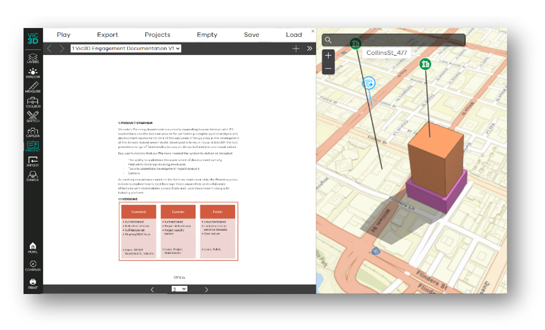
Vic3D is our 3D web-based viewer that provides a range of tools to support 3D spatial analysis and visualisation.
Using Vic3D you can:
These tools are available to our State and Local Government colleagues to enable all Victorians to access simple, effective spatial analysis.
Vic3D uses our deep domain expertise and engagement with users to develop a planning-centric platform that significantly uplifts the state’s planning capabilities and provides a suite of powerful 3D planning tools.
Watch the video to see how Vic3D supports 3D spatial analysis and visualisation.
The Layers tab provides flexibility to structure a range of 2D and 3D spatial and non-spatial data.
Layers give you easy access to information to support assessment and visualisation.
Dynamically display shadowing for a date and time, or across a time span.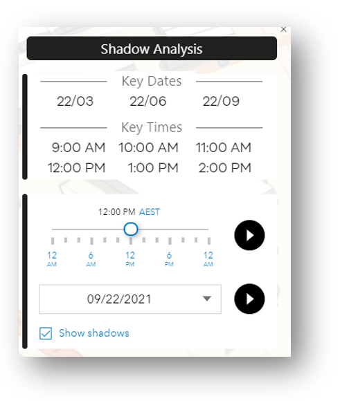
Take 3D measurements within the interface. Distance and area tools provide a simple way to take accurate measurements.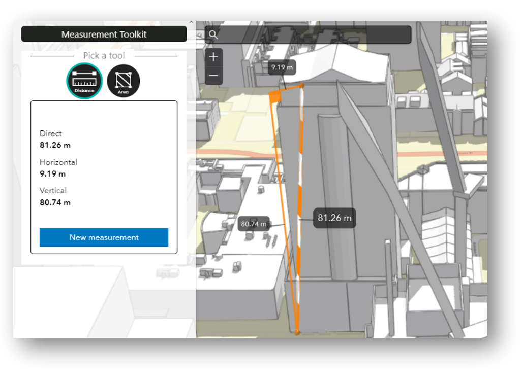
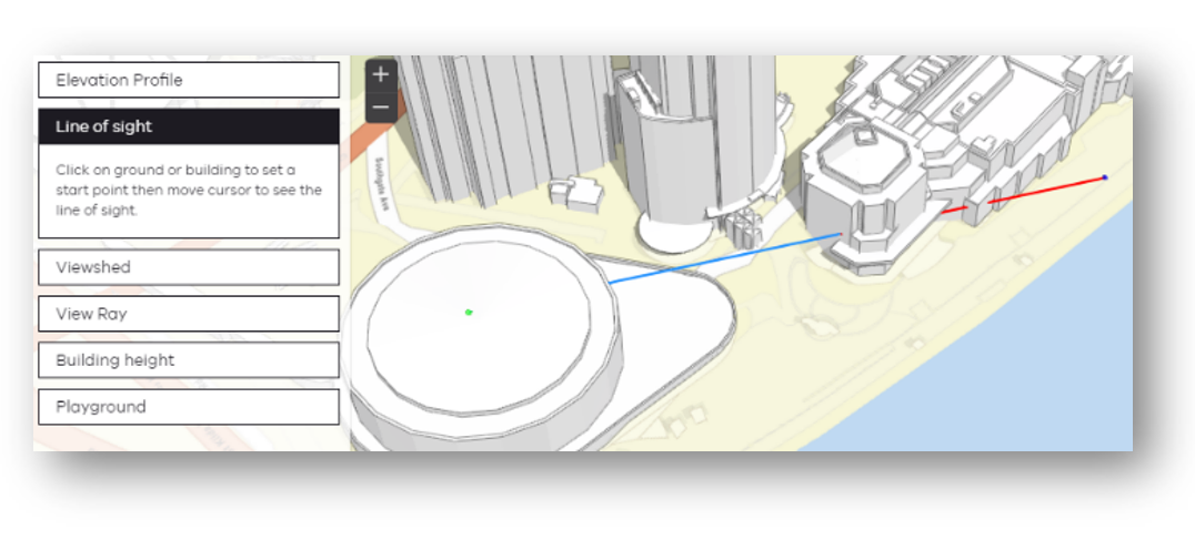
Line of sight allows you to perform visibility analysis. Visibility between an observer and multiple target points is calculated against currently displayed content in the view including:
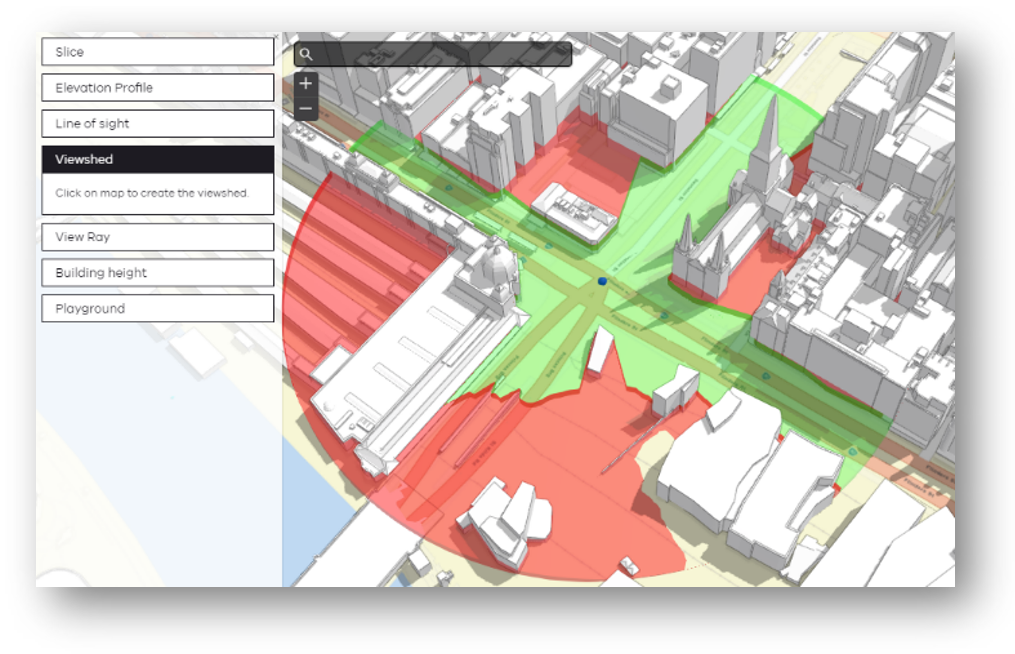
Viewshed allows you to define a point and generate a 360 degree viewshed for that location. Visible areas are marked in green and obscured targets are displayed as red.
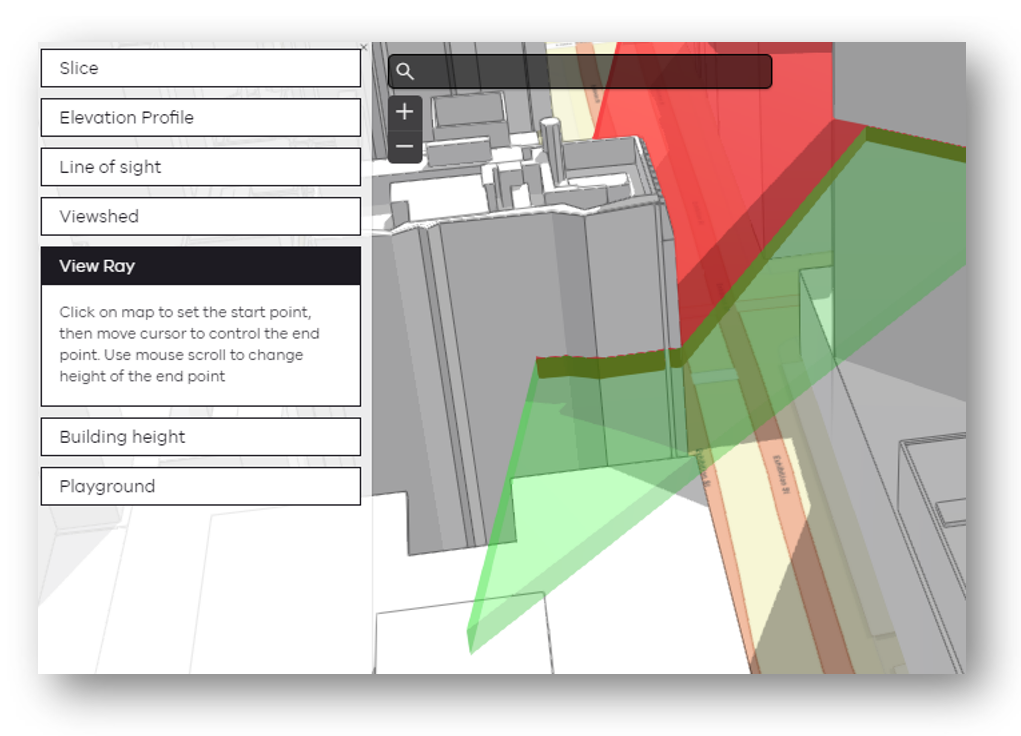
View ray is a dynamic version of Viewshed, you can move the focus around the interface to determine what’s visible. Visible areas are marked in green and obscured targets are displayed as red.
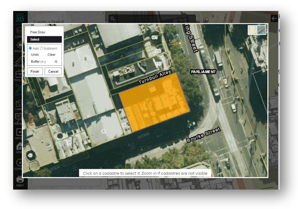
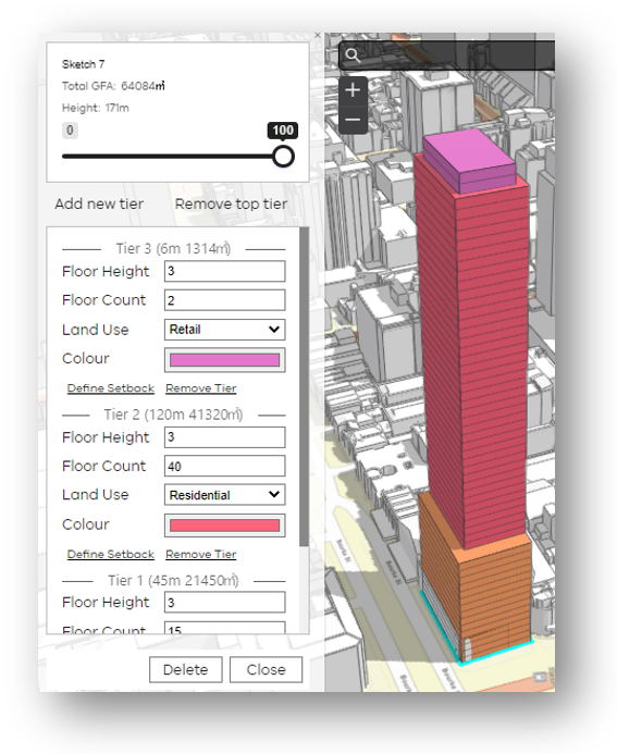
The sketch tool is a powerful feature to support visualising proposed buildings when the building model isn’t available.
You can sketch a building and define building segments with floors, floor heights and setback configurations. The buildings then form part of analysis in the interface, for example:
Buildings created using Sketch can be exported and shared with other Vic3D users.
Creating buildings in Vic3D is made easy with sketch:
Define specific view points within a scene to form part of fly view presentations through the interface. View points can also be converted to PDF or imported/exported.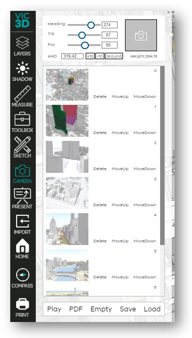
Presentation mode allows you to present from within Vic3D, without the need to switch between PowerPoint and a web browser.
Presentation mode has similar features to PowerPoint, for example:
Shadow accumulation
Display the amount of shadow that a building casts over time.
Elevation profile
Generate elevational profile of streetscape.
Building elevation
Visualise (by colour) buildings according to height range.
Create an image of the current display, that can be inserted into documents, emails and presentations.
Our team can help with:
Complete the form below and we will contact you about your project.
Page last updated: 28/02/25