
Reference
On this page:
The vision for St Georges Road (Thornbury)
The following vision for St Georges Road (Thornbury) train and tram zone activity centre is built from the Statement of Advice prepared by a Community Reference Group (CRG) made up of local residents.
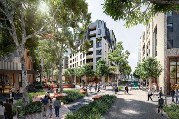
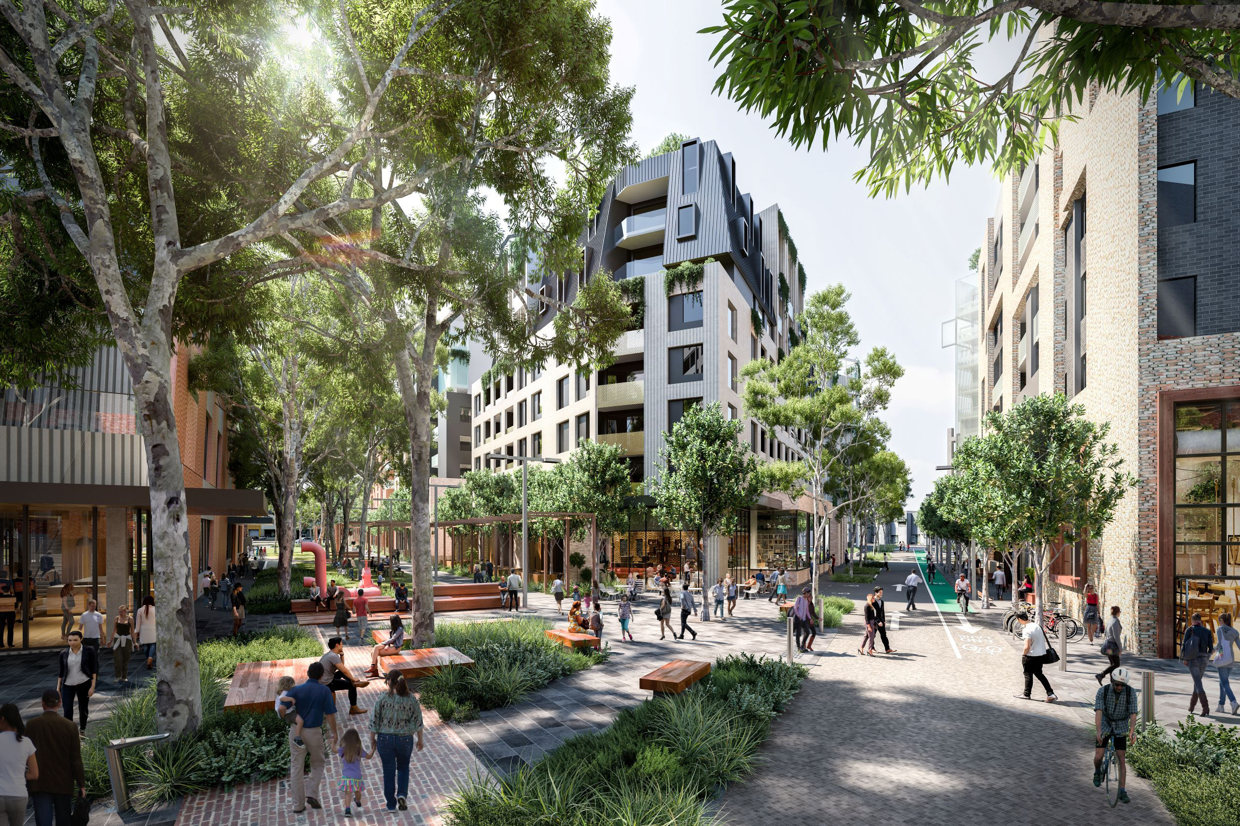
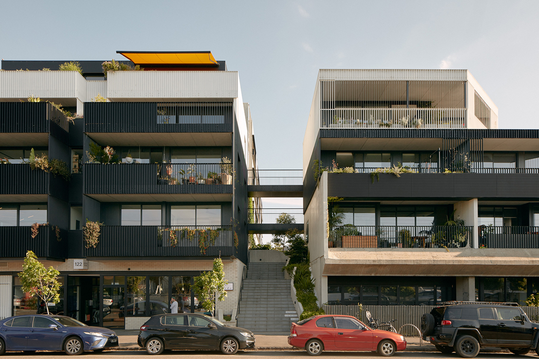
St Georges Road will grow from a transport corridor into a greener, more connected centre with a neighbourhood feel. New homes, shops and services will bring more activity to the street while keeping a relaxed, local feel and the important transport function.
Well‑designed mid‑rise buildings, wider footpaths and more greenery will make the area more attractive and comfortable for people walking and cycling.
Having housing accessible to local transport and infrastructure is very important. So is traffic management considering the impact an increase in population will have on safety and liveability.
What we understand about place and how we’ve addressed it
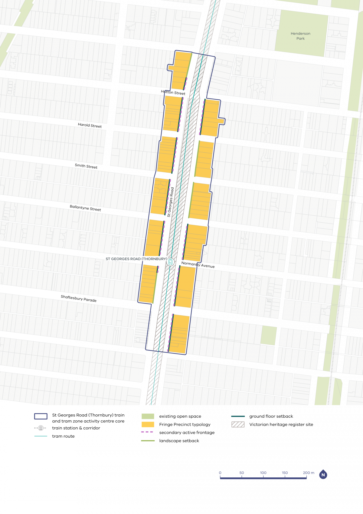
We understand that the residents and businesses of St Georges Road (Thornbury) are reliant on shops and services in neighbouring areas along High Street, Miller Street and Gilbert Road. That is why we have applied the fringe typology to all lots in the activity centre core, recognising the role of the centre as supporting the broader commercial and service offering located across Thornbury.
The CRG noted how important pedestrian safety is for people walking along St Georges Road. That is why we recommend new buildings maintain car access to their rear, away from footpaths along St Georges Road, enhancing pedestrian safety.
We heard that the community are generally supportive of density directed along the activity centre core of St Georges Road, with careful planning required to ensure continued safety and utility of St Georges Road as a transport corridor.
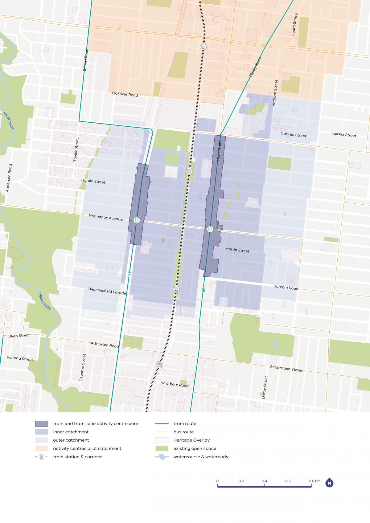
Thornbury core and catchment map

| Core | Inner catchment | Outer catchment |
|---|---|---|
| Various heights between six and 16 storeys in most centres, with potential for taller heights in some places in the larger centres | Up to four storeys, and up to six storeys on blocks larger than 1000m2 | Up to three storeys, and up to four storeys on blocks larger than 1000m2 |
St Georges Road (Thornbury) core and catchment explained
The core is the central part of the train and tram zone activity centre, closest to public transport, jobs and services. This area is best suited to accommodate more homes.
The catchment is the surrounding area within approximately 10 minutes’ walk of the core (around 800 metres).
As you move away from the commercial and community core of the train and tram zone activity centre, we expect that the proposed building heights will gradually decrease. This will allow a transition between the activity centre and the surrounding suburb.
The inner catchment responds to the lower scale commercial and service offering in this part of Thornbury. The outer catchment responds to heritage overlays and access to services.
What we are doing for your community
As part of our work, we've:
- applied front setbacks to increase space for pedestrians and create opportunity for activation along St Georges Road
- implemented landscape setbacks, encouraging the planting of greenery to improve pedestrian amenity and enhance St Georges Road as a place to live
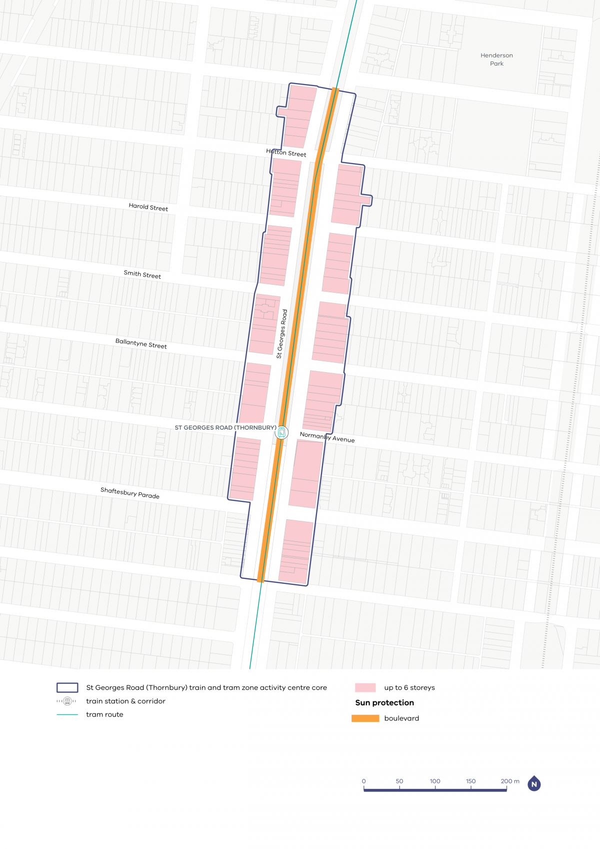
- applied a lower six-storey height limit in the core, providing a level of growth appropriate to the centre’s key transport role and services provision.
Refer to the following plans:
- Plan 5: St Georges Road (Thornbury) typology, activation and setbacks
- Plan 6: St Georges Road (Thornbury) building heights and sun protection
Plans
The built form outcomes and building heights for the activity centre core are set out on the following plans:
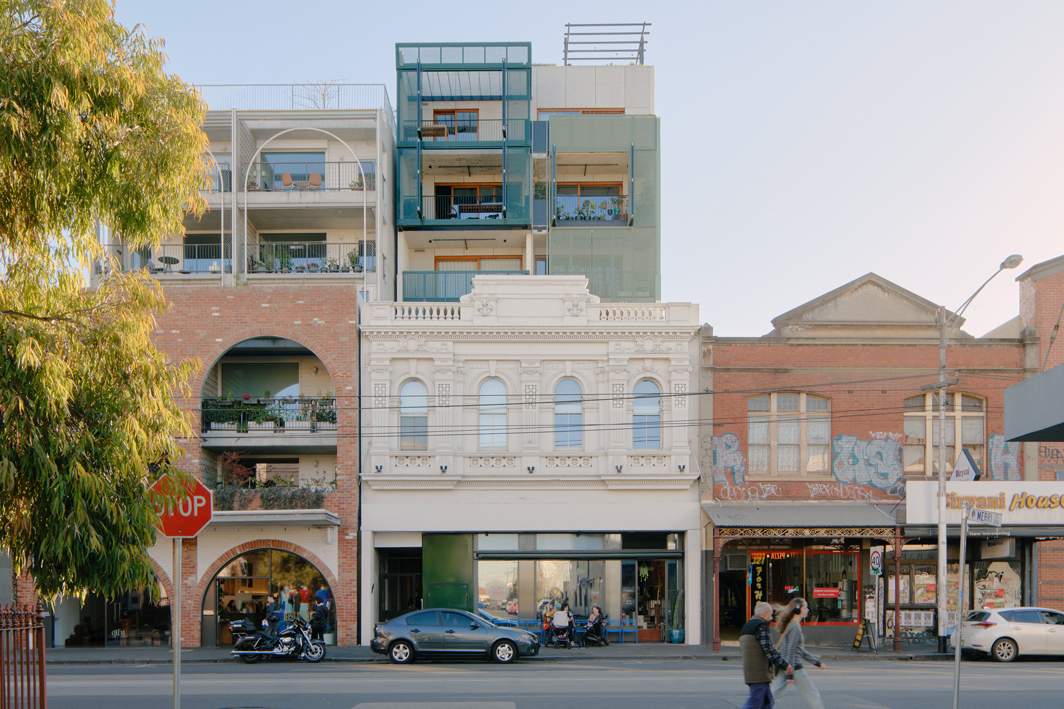
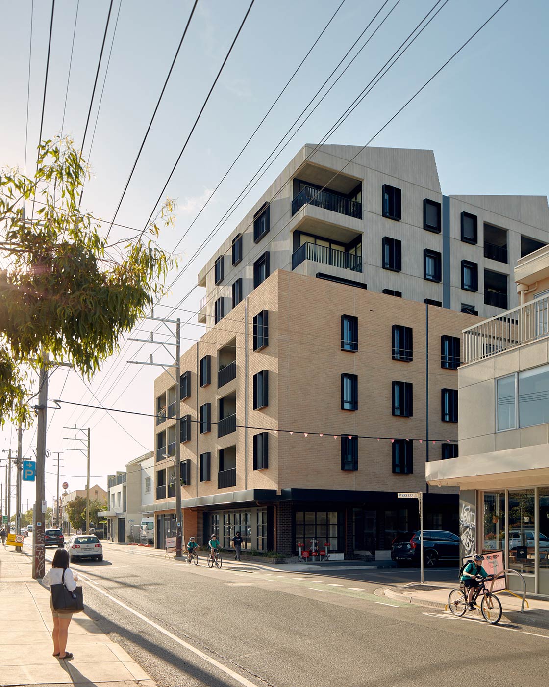
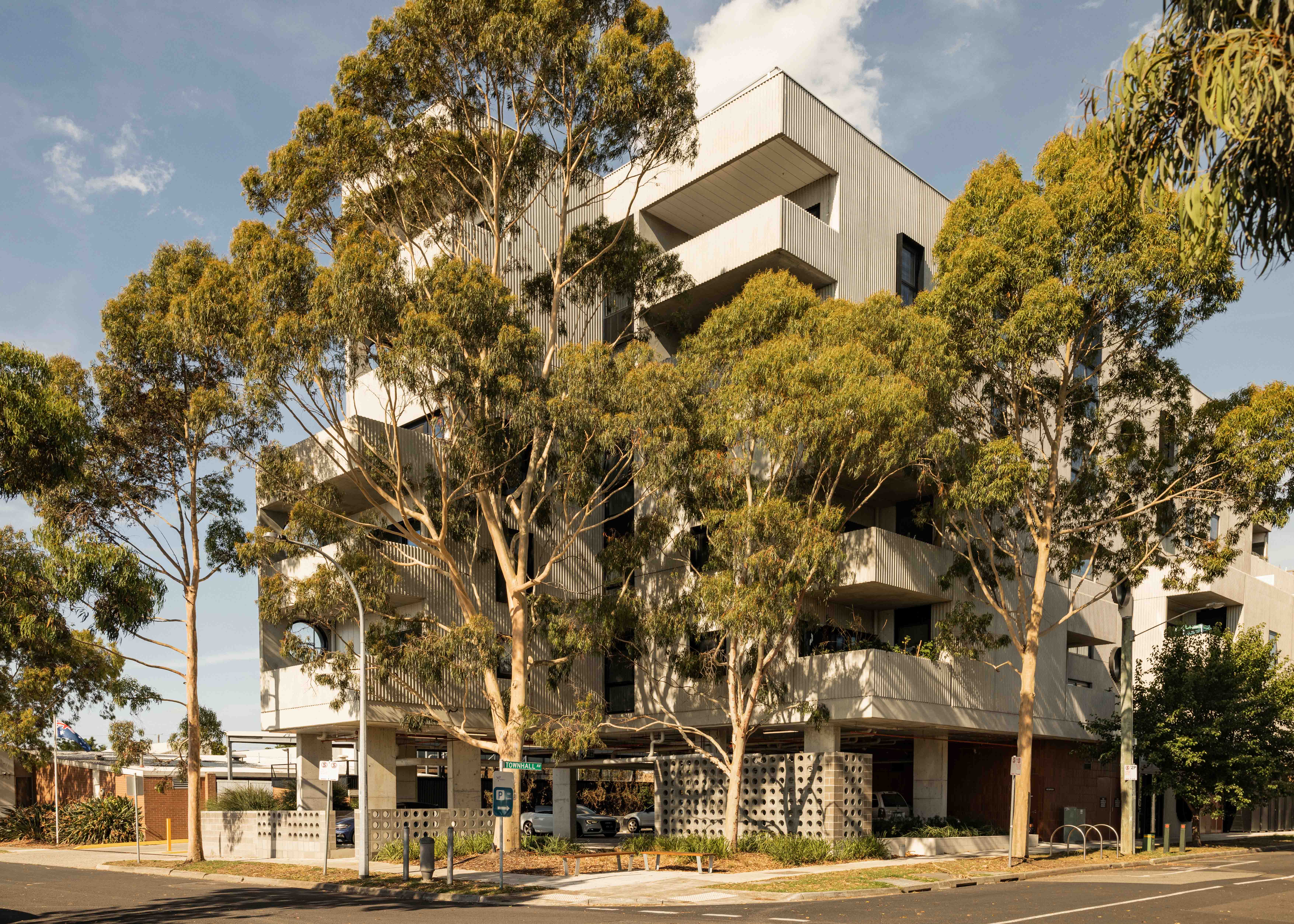
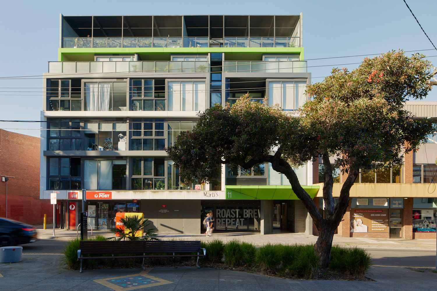
The plans support the right types of homes being built in the places they fit best. These are some of the kinds of homes you might see more of in the future.
- Activity Centre Core - large opportunity site

- Activity Centre Core - main street precinct
- Activity Centre Core - limited sensitivities precinct

- Activity Centre Core - fringe precinct

- Activity Centre Core - residential precinct
- Inner Catchment
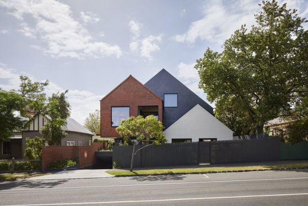
- Outer Catchment
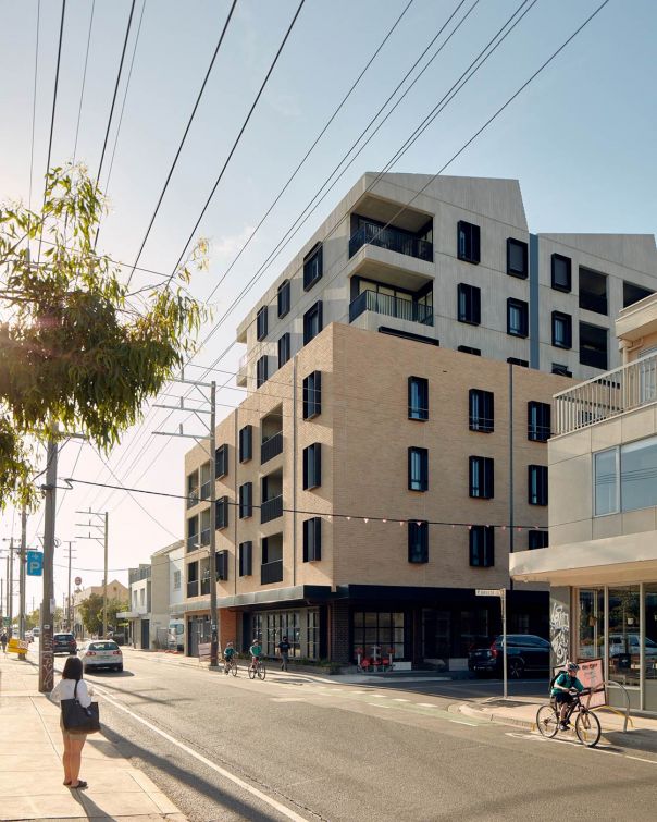
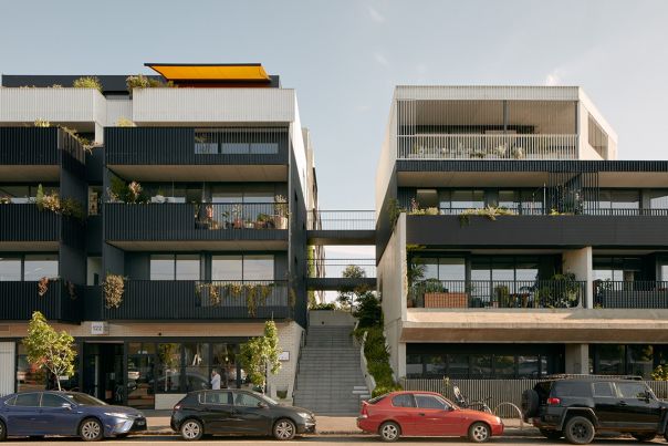
Activity Centre Core - large opportunity site
Activity Centre Core - main street precinct
Activity Centre Core - limited sensitivities precinct
Activity Centre Core - fringe precinct
Activity Centre Core - residential precinct
Inner Catchment

Outer Catchment
Page last updated: 12/05/26