
Reference
On this page:
The vision for Hawthorn
The following vision for Hawthorn train and tram zone activity centre is built from the Statement of Advice prepared by a Community Reference Group (CRG) made up of local residents.
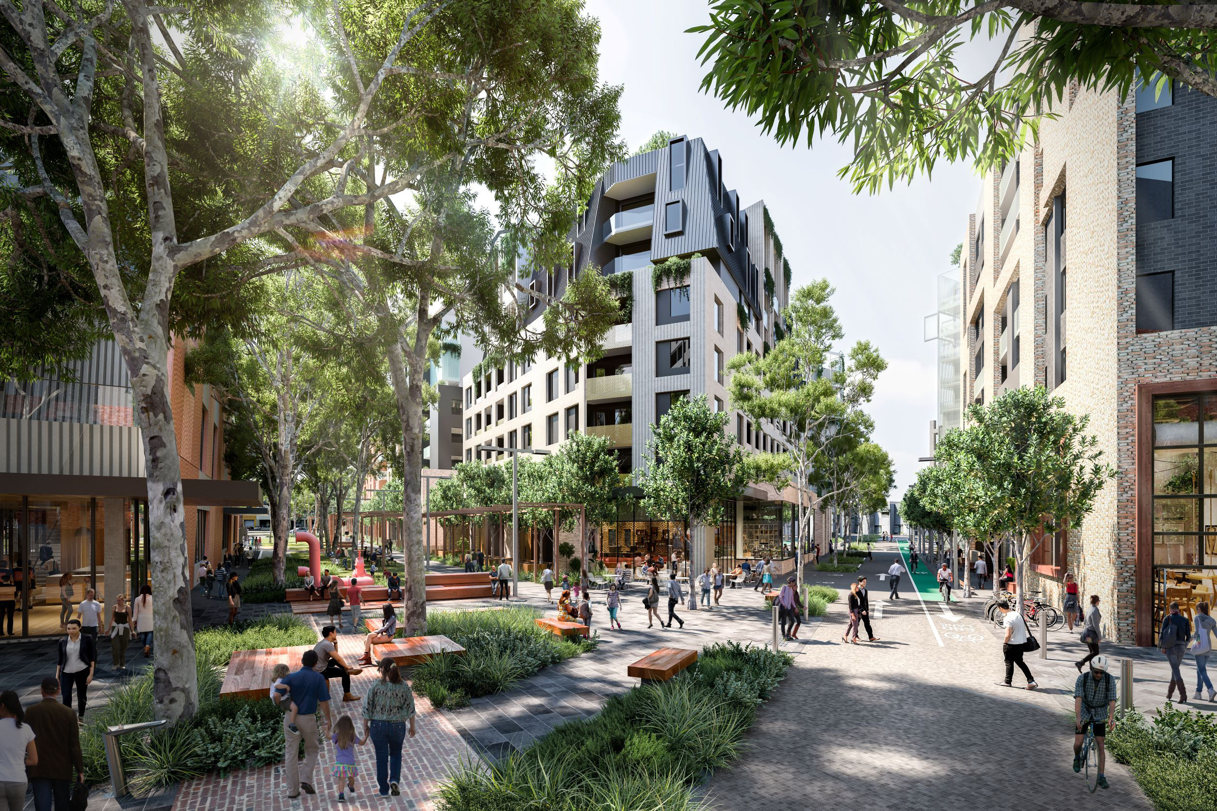
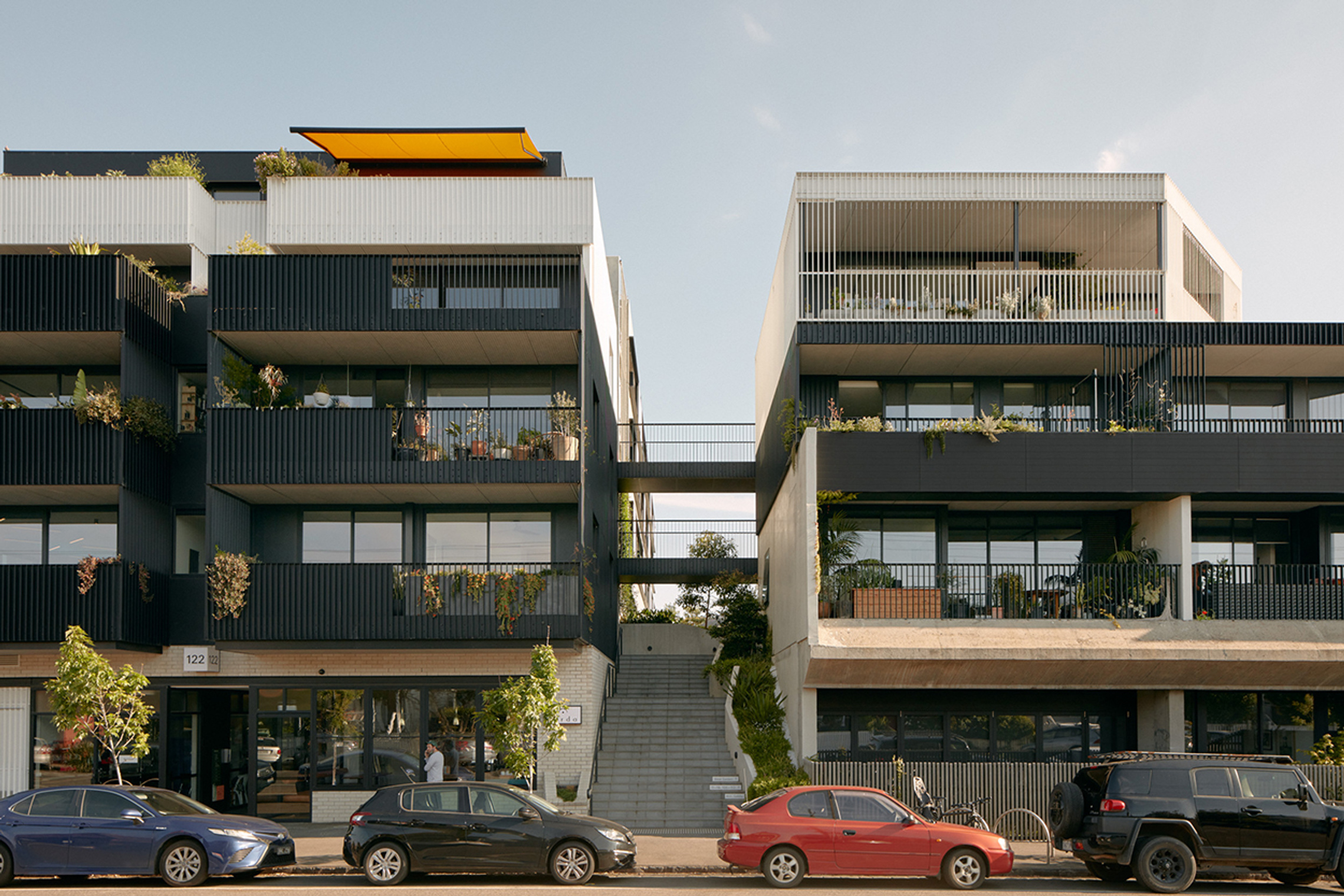
Hawthorn’s leafy streets and strong local identity create a welcoming environment where people enjoy spending time. The centre offers diverse options for new homes, a mix of small businesses and larger retailers, and exceptional access to the central city.
Its proximity to an emerging allied health precinct supports local living and contributes to the area’s vibrancy. With a blend of historic homes and newer apartments, Hawthorn will continue to attract people of all ages and backgrounds.
Development must balance housing needs with preserving a human-scaled, connected, and accessible community.
What we understand about place and how we’ve addressed it
The CRG recognised Hawthorn as an easy to get around centre with green, human‑scale streets that feel welcoming.
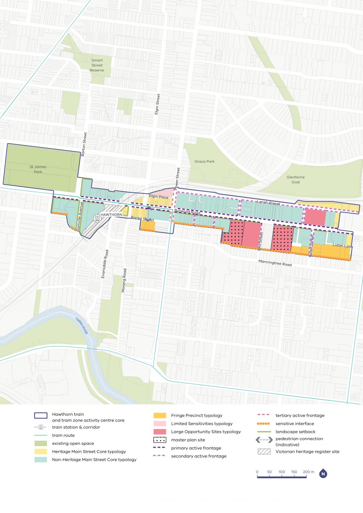
As part of our planning for the core, we have incorporated requirements for landscaped setbacks to protect and encourage greening, as well as the Heritage Main Street Core typology along Burwood Road, close to Hawthorn Station, to maintain human scale street walls and its heritage values.
We heard that the community is generally supportive of increased density that does not compromise heritage, delivers greater housing choice and encourages increased activity around the Hawthorn centre.
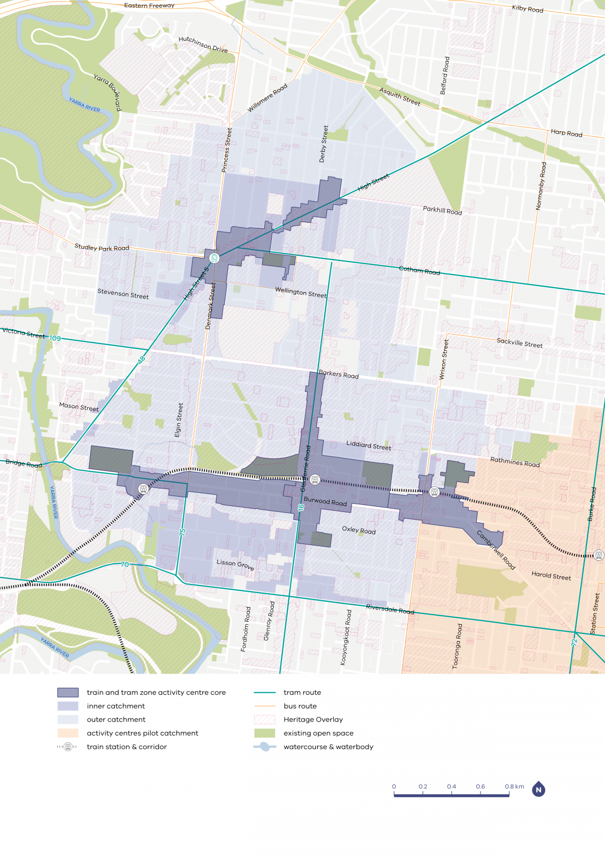
Hawthorn, Glenferrie, Auburn and Kew Junction core and catchment map

| Core | Inner catchment | Outer catchment |
|---|---|---|
| Various heights between six and 16 storeys in most centres, with potential for taller heights in some places in the larger centres | Up to four storeys, and up to six storeys on blocks larger than 1000m2 | Up to three storeys, and up to four storeys on blocks larger than 1000m2 |
Hawthorn core and catchment explained
The core is the central part of the train and tram zone activity centre, closest to public transport, jobs and services. This area is best suited to accommodate more homes.
The catchment is the surrounding area within approximately 10 minutes’ walk of the core (around 800 metres).
As you move away from the commercial and community core of the train and tram zone activity centre, we expect that the building heights will gradually decrease. This will allow a transition between the activity centre and the surrounding suburb.
In Hawthorn, the outer catchment is bounded by Riversdale Road to the south and the Significant Landscape Overlay for the Yarra River to the west. It also extends north towards Kew Junction and east towards Glenferrie.
The inner catchment is predominantly south of the activity centre core towards Riversdale Road, which is serviced by trams. It extends to Church Street, which is also serviced by trams.
What we are doing for your community
As part of our work, we've:
- applied landscape setbacks to the south side of Burwood Road to allow for vegetation and improve sun access and amenity to the road
- applied active frontages along Burwood Road and Lynch Street to promote commercial and retail uses at ground level and encourage a vibrant street life
- applied sensitive interface controls to protect the amenity of residential properties south of Burwood Road
- applied high solar protection to the heritage retail areas along Burwood Road to protect and enhance street activity and pedestrian experience
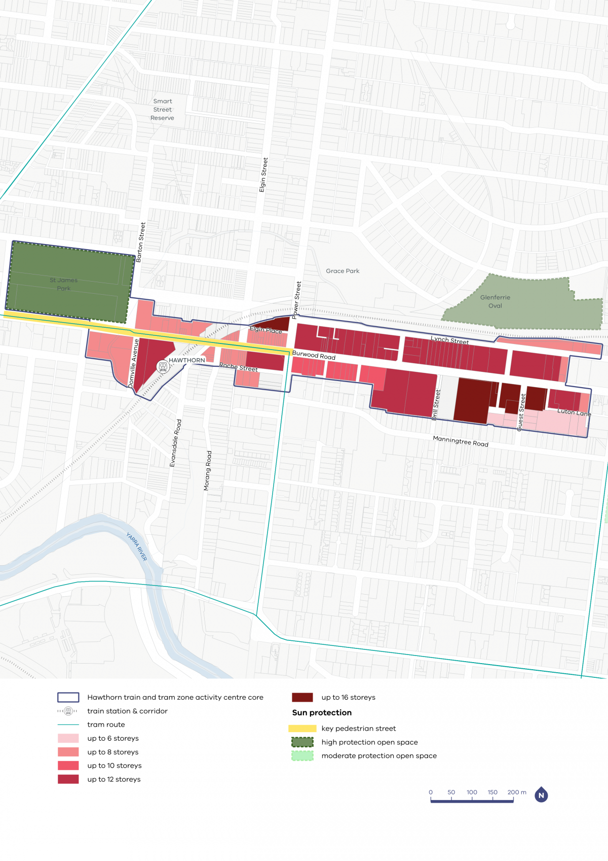
- applied heights of up to 12 to 16 storeys to larger sites capable of higher development
- lowered building heights to properties along the Manningtree Road residential area.
Refer to the following plans:
- Plan 3: Hawthorn typology, activation and setbacks
- Plan 4: Hawthorn building heights and sun protection
Plans
The built form outcomes and building heights for the activity centre core are set out on the following plans:
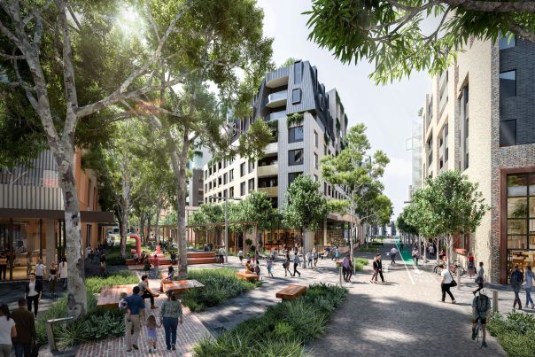
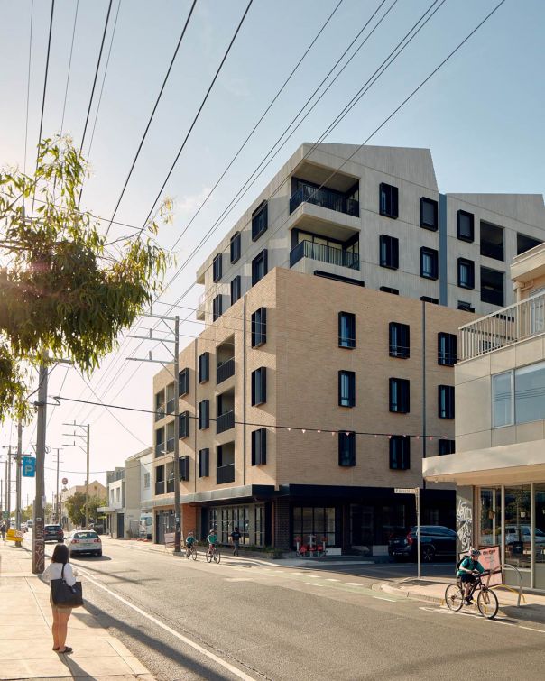
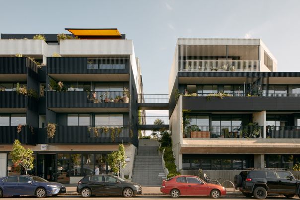
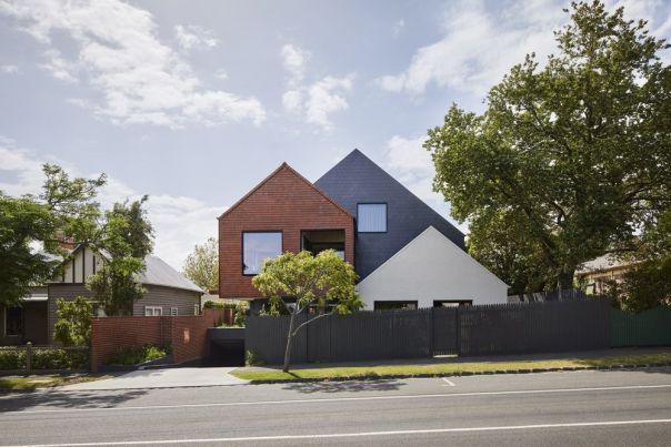
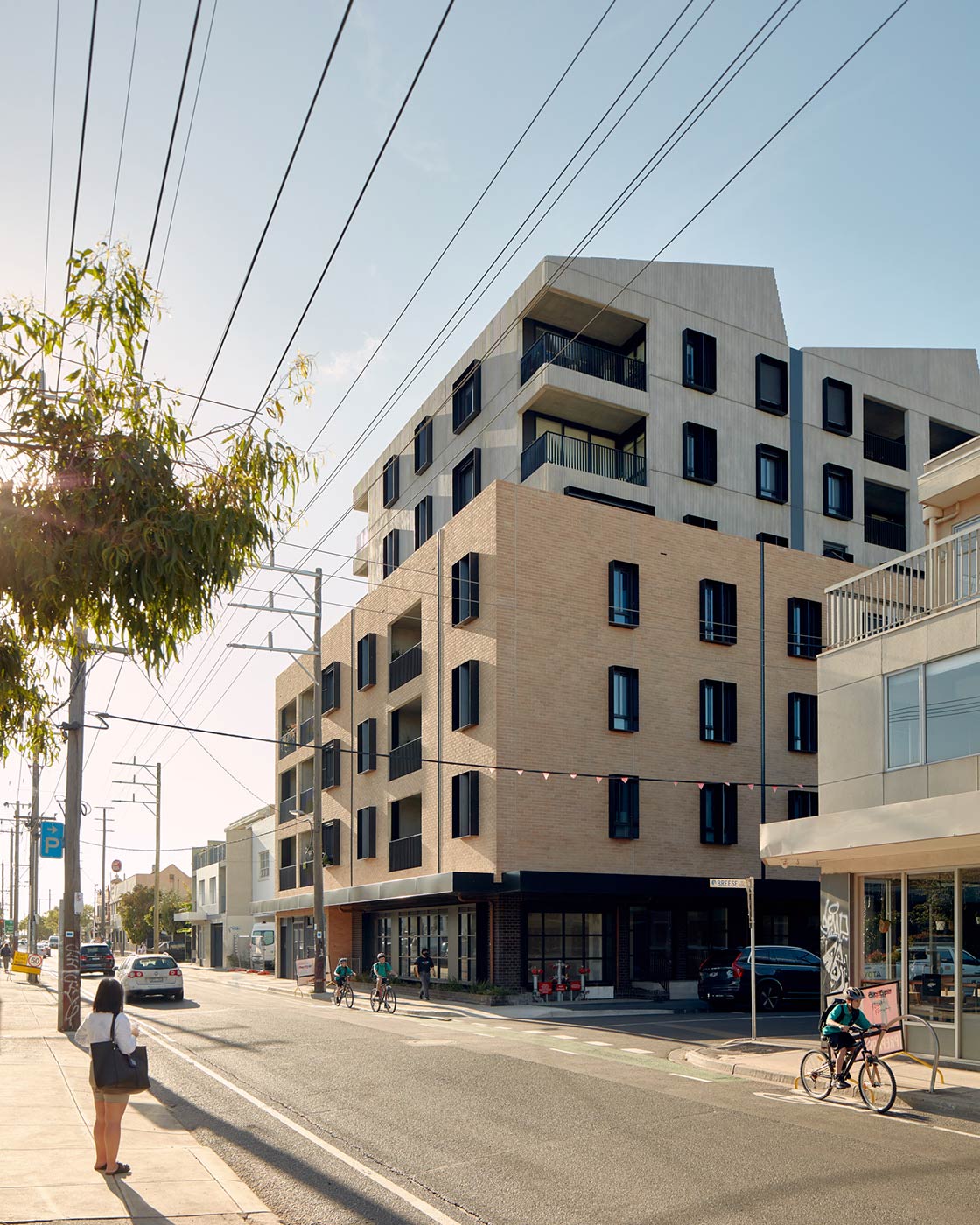
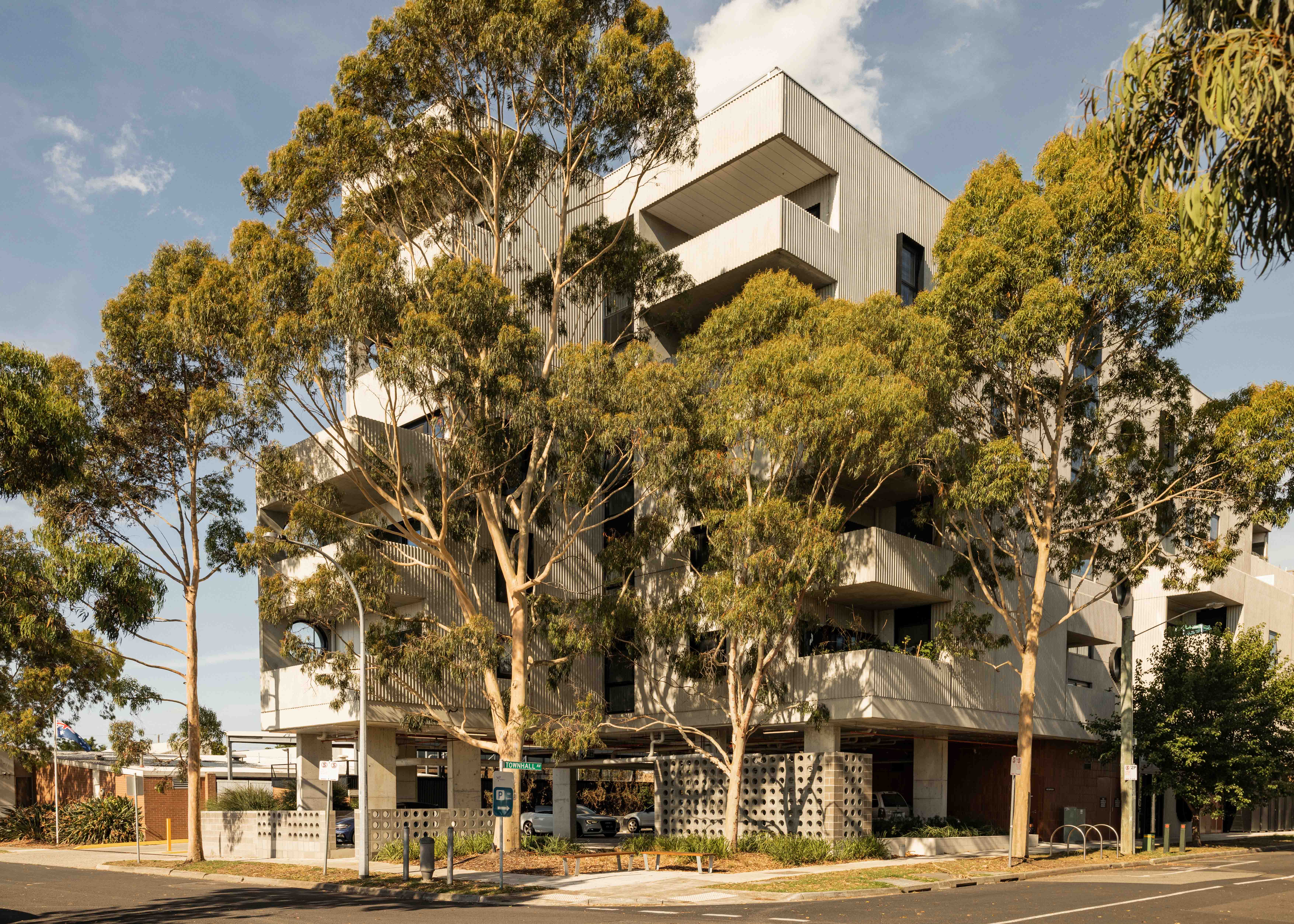
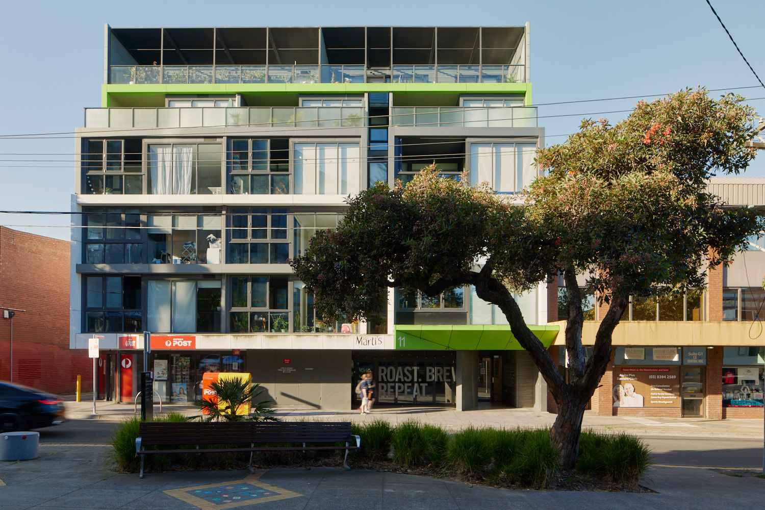
The plans support the right types of homes being built in the places they fit best. These are some of the kinds of homes you might see more of in the future.
- Activity Centre Core - large opportunity site

- Activity Centre Core - main street precinct
- Activity Centre Core - limited sensitivities precinct

- Activity Centre Core - fringe precinct

- Activity Centre Core - residential precinct
- Inner Catchment
- Outer Catchment
Activity Centre Core - large opportunity site
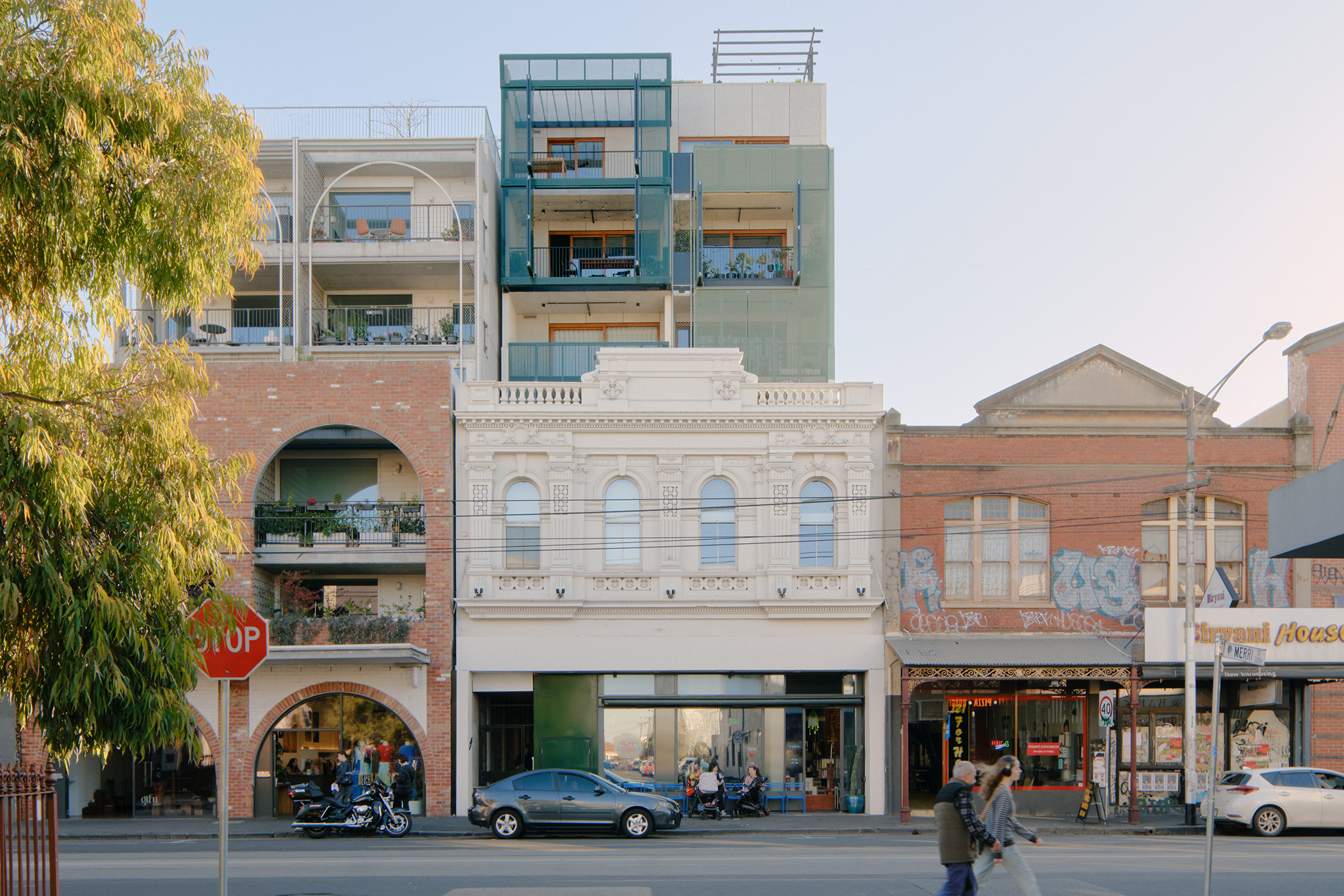
Activity Centre Core - main street precinct
Activity Centre Core - limited sensitivities precinct
Activity Centre Core - fringe precinct
Activity Centre Core - residential precinct
Inner Catchment

Outer Catchment
Page last updated: 12/05/26