Victoria in future
The official Victorian state government projection of population and households.
Find out more
In this section
-
Discover and access planning open data
Find, understand and download planning data.
-
Explore planning through maps and 3D
Explore the range of spatial applications that enable ease of interaction with the Planning Scheme, other Planning related spatial datasets ...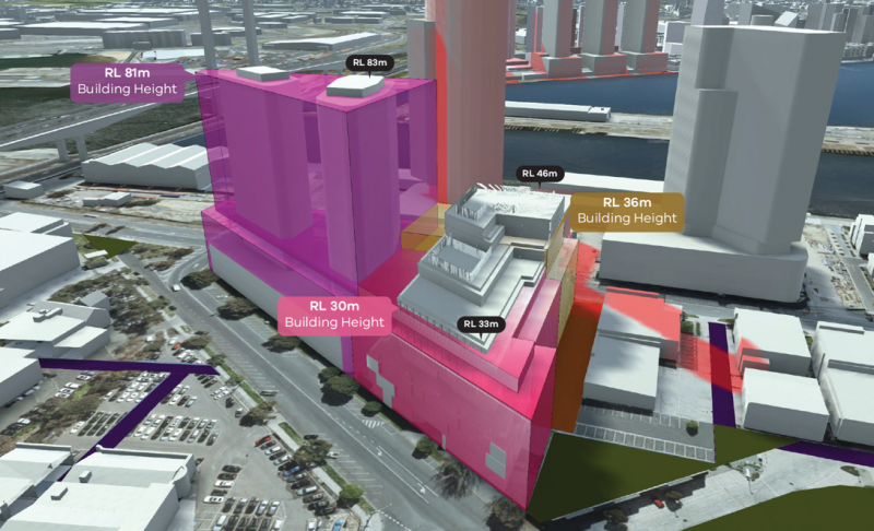
-
Use planning data
Explore available data services, learn how to programmatically navigate and access planning data.