
The principles may be relevant to a wide range of decisions and activities, including:
- strategic planning
- planning scheme amendments
- planning permit applications
- infrastructure and transport projects
- policy and program development
- land and asset management
- operational activities undertaken by Responsible Public Entities.
The circumstances in which the Protection Principles must be considered depend on the decision-maker, the function being exercised and the land affected. Obligations commonly overlap and may arise under the Birrarung Act, planning schemes, Ministerial Directions and other legislation.
While statutory obligations rest with decision-makers, proponents should also consider the Protection Principles when developing proposals. Early consideration can strengthen project design, identify opportunities to improve outcomes for Birrarung and support more efficient assessment and decision-making processes.
The table below identifies when different decision makers need to consider the Protection Principles and the land to which those obligations apply.
When the Protection Principles apply to decision-making
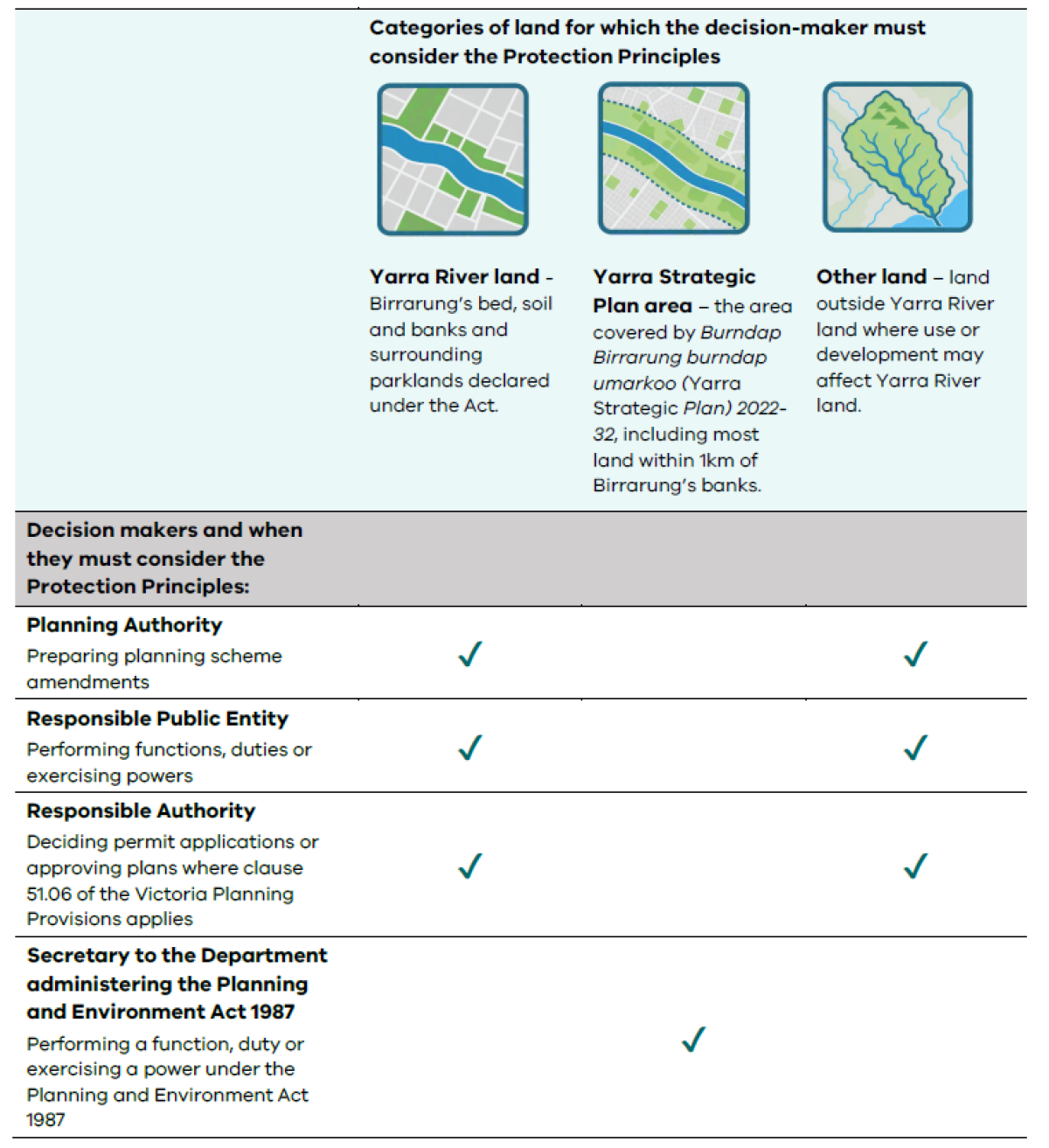
Exemptions may apply to decisions relating to declared projects under the Major Transport Projects Facilitation Act 2009 and projects under the Suburban Rail Loop Act 2021.
Land that may affect Yarra River land
Use and development outside Yarra River land may still affect the river and her lands. Across Birrarung’s catchment, decision-makers should consider potential direct, indirect, cumulative and catchment-wide impacts.
The Protection Principles must be considered for any proposal that may affect the river and her lands, regardless of whether the potential affects are positive or negative.
Identifying relevant land
Use the Yarra River Land Webmap to identify whether land is:
- Yarra River land
- within the Yarra Strategic Plan area, or
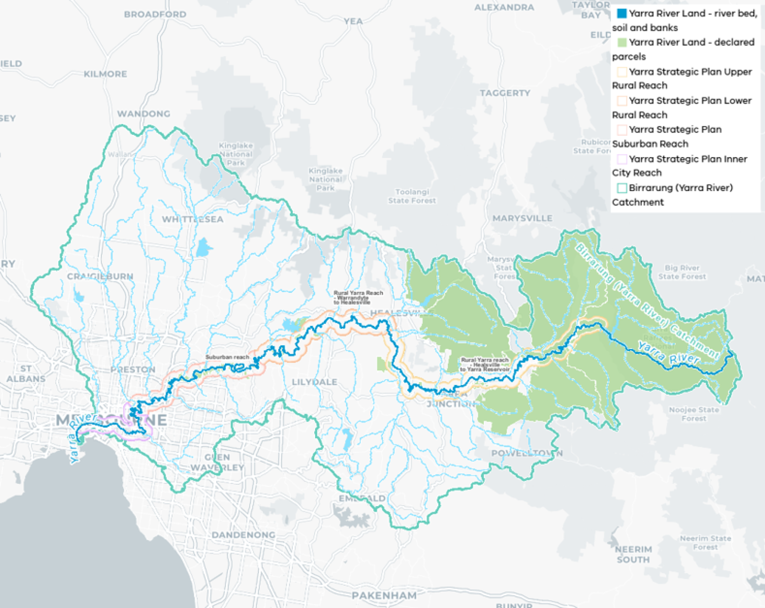
- within the Birrarung catchment where use or development may affect Yarra River land.
Users can search by address or location to identify the relevant land category.
Birrarung's Catchment as shown in the Yarra River land WebMap
Page last updated: 30/10/26