
Reference
On this page:
The vision for Noble Park
The following vision for the Noble Park train and tram zone activity centre is built from the Statement of Advice prepared by a Community Reference Group (CRG) made up of local community members.
Noble Park will remain a thriving, walkable and welcoming place that supports the day-to-day needs of the local community.
New homes will bring more people to support local businesses, while responding to the existing feel of Noble Park.
Noble Park will build on its cohesive character to create a lively, yet relaxed environment, which balances growth with the protection of key public areas.
"As a homeowner in the area, I strongly support the development of Noble Park Station activity centre to accommodate more housing."
What we understand about the place and how we’ve addressed it
Noble Park is known for its village character, which fosters a strong sense of local identity among residents.
Its amenities and public open spaces, including the station civic space, the Djerring Trail, leisure and exercise areas within Ross Reserve, the Noble Park Aquatic Centre, and shops along Douglas Street and Heatherton Road provide the things residents, workers and visitors need.
The Community Reference Group highlighted their appreciation of Noble Park’s village character in shaping a strong sense of place and the importance of open spaces, parks and gardens.
As part of our work, we’ve:
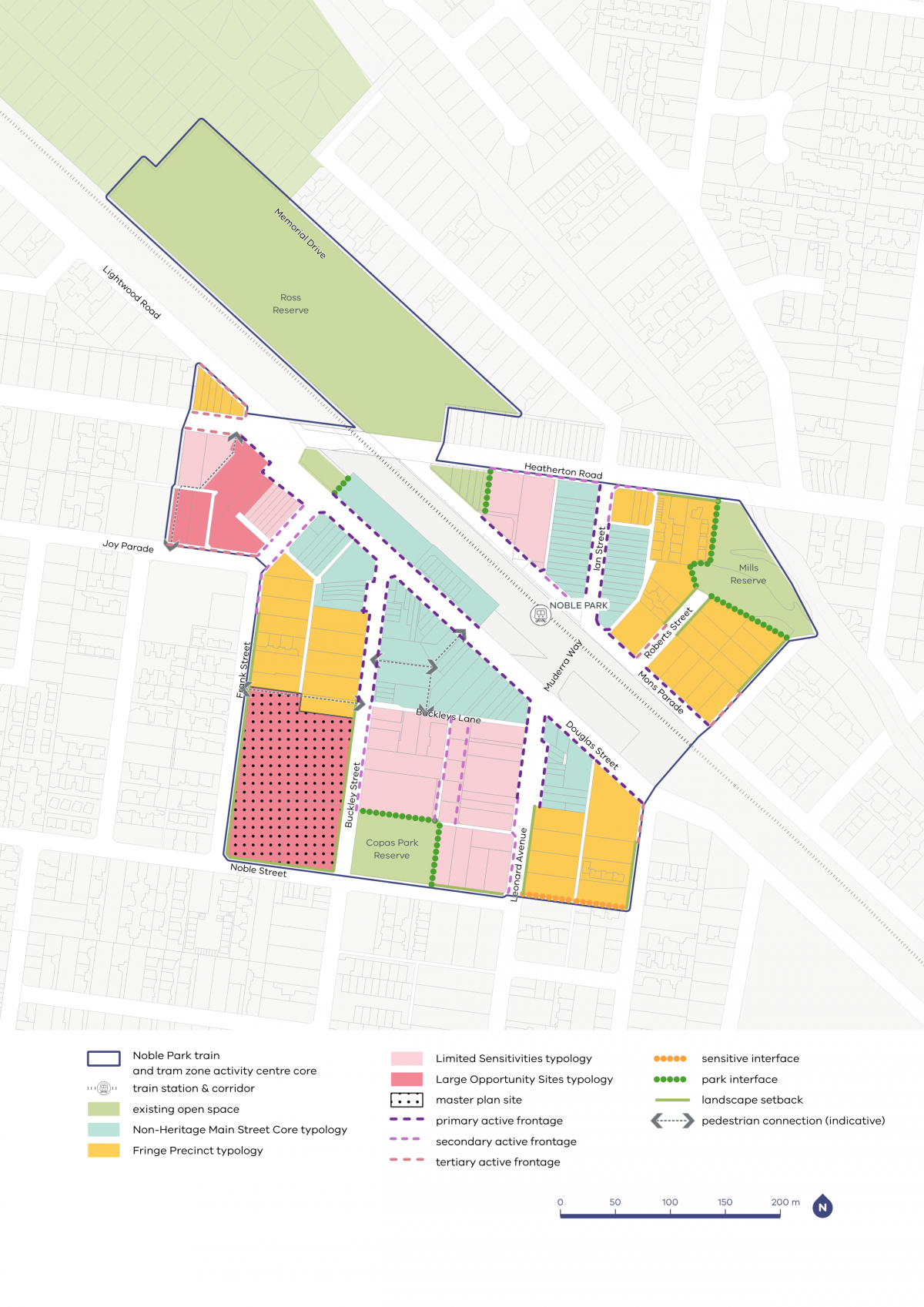
- applied landscape setbacks around existing open spaces and at residential interfaces to provide for greener streetscapes around parks and residential areas
- applied active frontages along key streets to ensure new buildings keep these streets vibrant and interesting
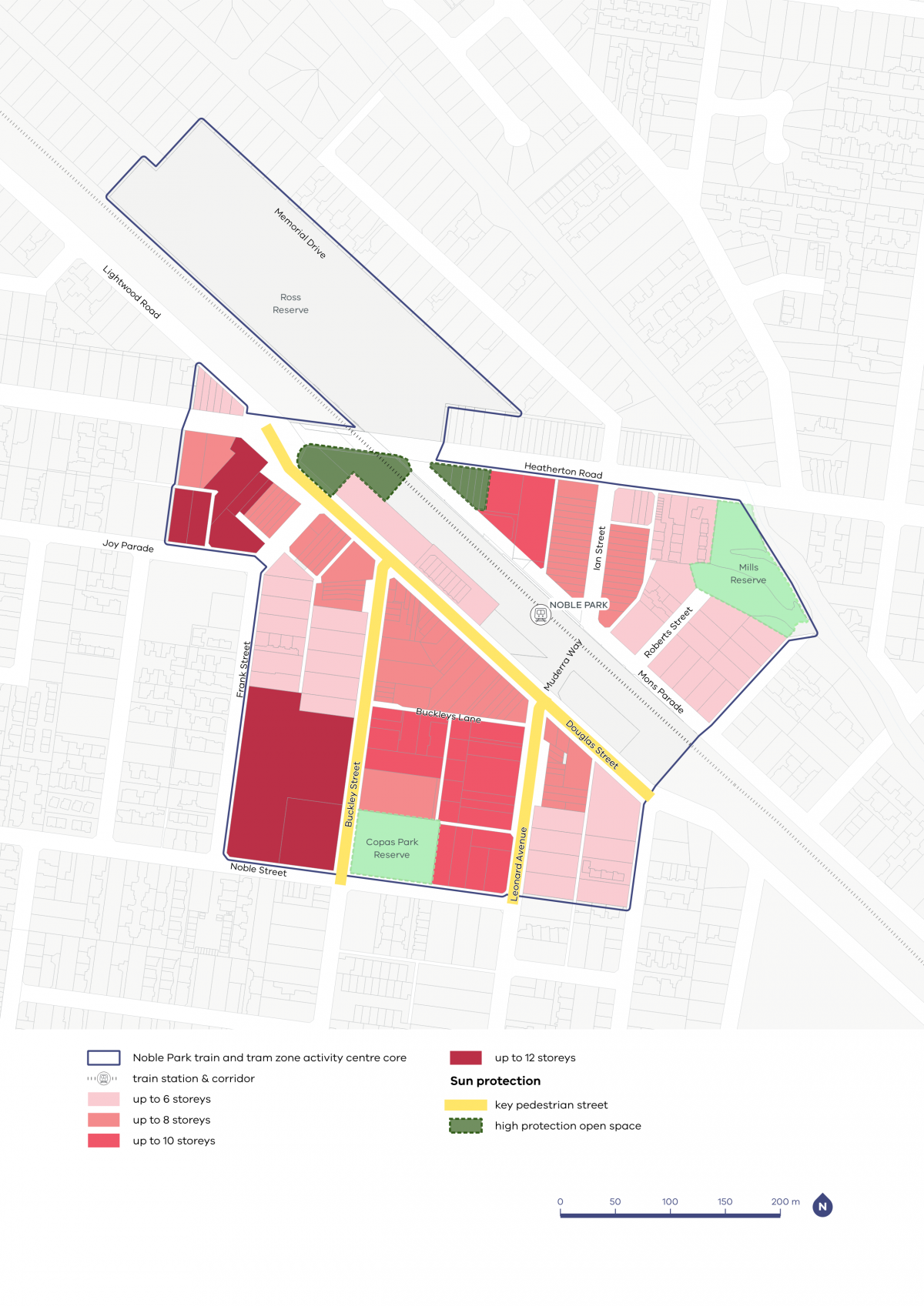
- located the tallest building heights at larger, key opportunity sites where there is more space to transition to surrounding areas
- specified a maximum height of six to eight storeys for most of the centre to reflect the village character and respond sensitively to the surrounding neighbourhood
- applied solar protection along Douglas Street and Buckley Street where the shops are located, and around Copas Park where people like to spend their leisure time.
Noble Park core and catchment map
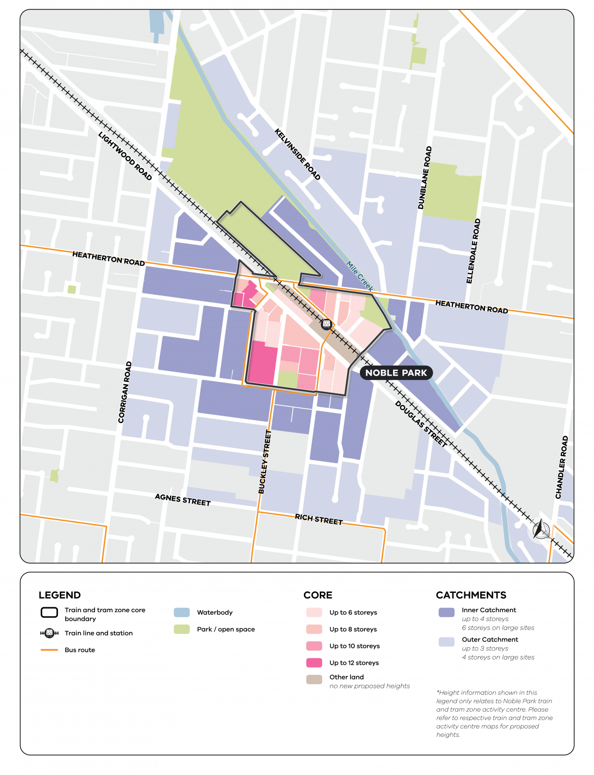
View the Springvale to Dandenong core and catchment map.
Noble Park core and catchment explained
The core is the central part of the train and tram zone activity centre, closest to public transport, jobs and services. This area is best suited to accommodate more homes.
The catchment is the surrounding area within approximately 10 minutes’ walk of the core (around 800 metres).
As you move away from the commercial and community core of the train and tram zone activity centre, we expect that the proposed building heights will gradually decrease. This will allow a transition between the activity centre and the surrounding suburb.
In Noble Park, the inner catchment is applied where access to services, goods and transport is best provided.
The outer catchment has been reduced in the south-west in response to community feedback regarding walkability and access.
Visit the How we’re planning page to find out more about core and catchment areas, new planning tools, streamlined planning processes and the approach to delivering more homes in train and tram zone activity centres.
Activity centre plans
The built form outcomes and building heights for the activity centre core are set out on the following plans:
Plan 5: Noble Park typology, activation and setbacks.
Plan 6: Noble Park building heights and sun protection.
The plans support the right types of homes being built in the places they fit best.
Page last updated: 02/10/26