
Reference
On this page:
The vision for Toorak Village
The following vision for the Toorak Village train and tram zone activity centre is built from the Statement of Advice prepared by a Community Reference Group (CRG) made up of local community members.
Toorak Village will continue to thrive as a distinctive and vibrant centre, with additional housing supporting its compact mix of commercial, retail and hospitality services.
Greater housing outcomes will be focused on strategic sites on Toorak Road, reinforcing the area’s valued character as a neighbourhood already featuring more apartments and flats than detached houses.
"Prioritising height along main transport routes supports efficient land use, encourages sustainable transport outcomes, and aligns with strategic planning objectives to concentrate growth in accessible locations."
What we understand about the place and how we’ve addressed it
Toorak Village is a vibrant centre well serviced by trams, comprising a diverse mix of activities and large-scale contemporary developments.
The Community Reference Group highlighted that it was an appropriate centre for housing growth, particularly around the tram corridor.
The Community Reference Group also noted how important the protection of Toorak Road and Grange/Canterbury Roads were for people to live, work, shop and dine. Additionally, Jackson Street was highlighted to be a key street that was frequently used to access the Toorak Campus of Geelong Grammar School.
We heard that the community values the heritage shopfronts located east of Toorak Road, which contribute to the area’s distinctive character.
We also heard that the community is very supportive of increased heights on the large Trak Centre site as it has existing building heights of up to 11 storeys.
As part of our work, we've applied:
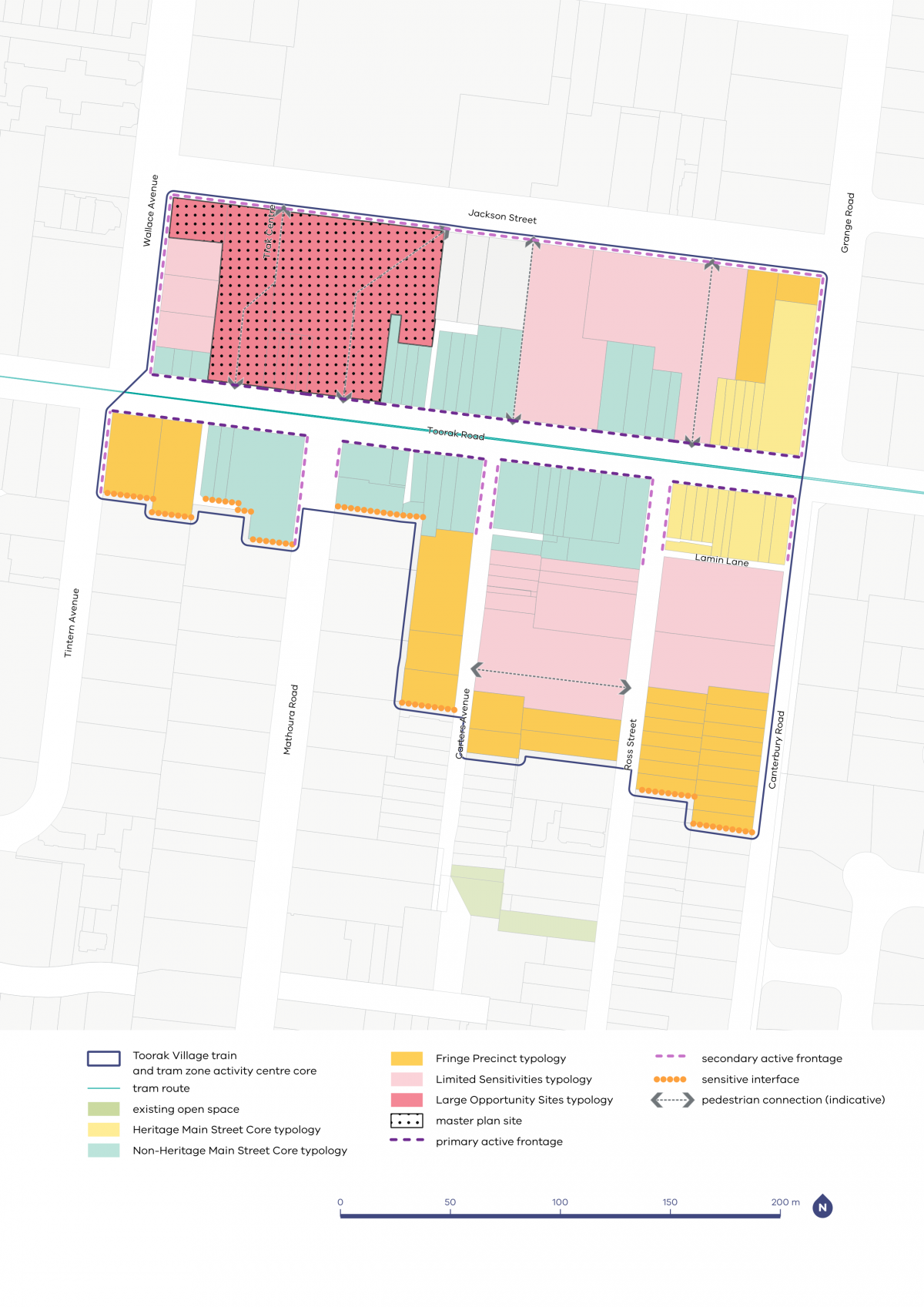
- master planning requirements to the Tok H and Trak Centre to encourage site-specific design responses such as public realm improvements, overshadowing protection for possible future open spaces, or pedestrian connections
- ground floor setbacks to sensitive interfaces on the southern property boundaries that interface with properties outside of the activity centre core. This will create a smooth transition to surrounding residential areas
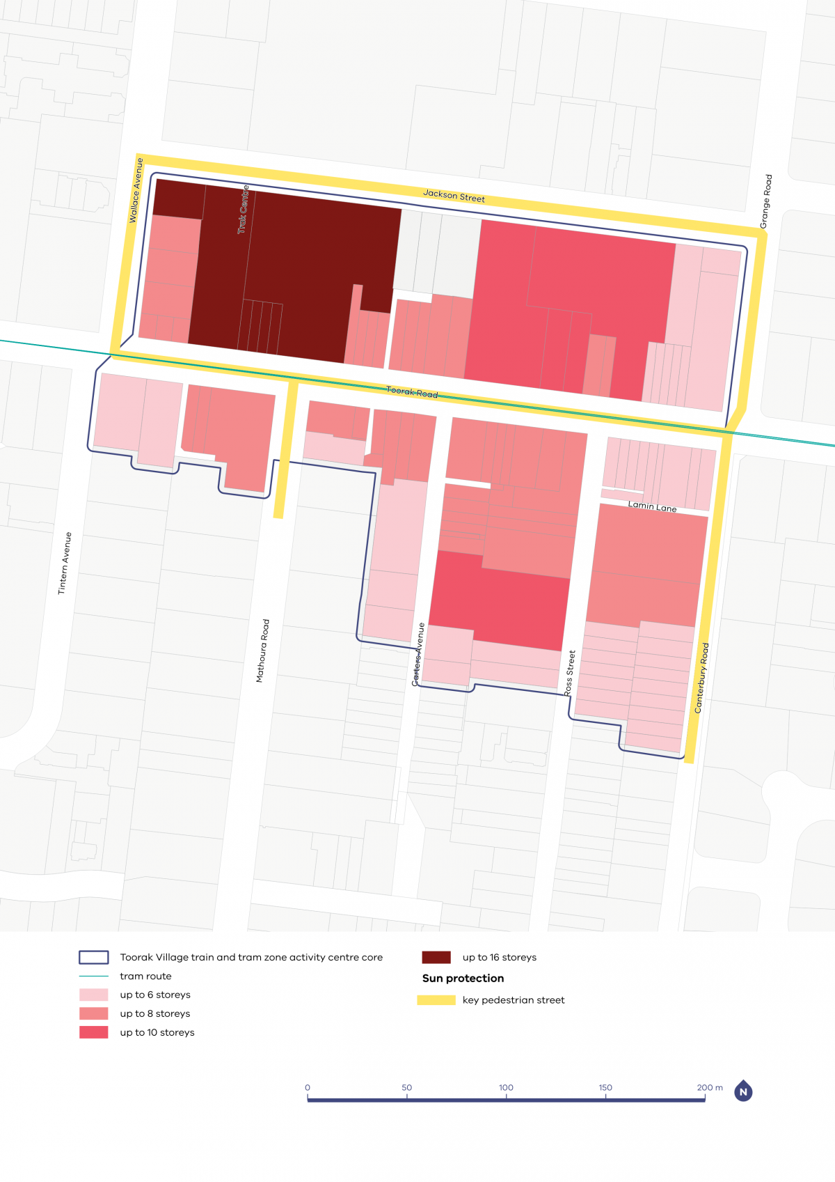
- sun protection on Toorak Road, to ensure increased building heights will not overshadow footpaths and keep Toorak Road an attractive street for walking and gathering
- taller building heights of 10 to 16 storeys to properties where built form modelling has determined they can be achieved with good design outcomes. In some cases, these heights are reflected of existing developments of a similar height.
Toorak Village core and catchment map
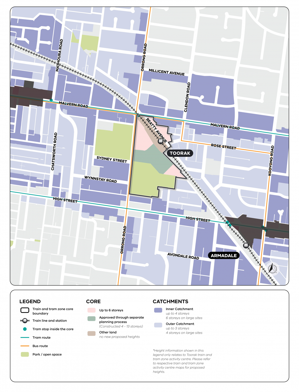
View the Hawksburn to Malvern and Toorak Village core and catchment map.
Toorak Village core and catchment explained
The core is the central part of the train and tram zone activity centre, closest to public transport, jobs and services. This area is best suited to accommodate more homes.
The catchment is the surrounding area within approximately 10 minutes’ walk of the core (around 800 metres).
As you move away from the commercial and community core of the train and tram zone activity centre, we expect that the proposed building heights will gradually decrease. This will allow a transition between the activity centre and the surrounding suburb.
In Toorak Village, community feedback supported housing growth on main roads, serviced by trams and buses, which can connect residents quickly to a train station and commercial core.
Visit the How we’re planning page to find out more about core and catchment areas, new planning tools, streamlined planning processes and the approach to delivering more homes in train and tram zone activity centres.
Activity centre plans
The built form outcomes and building heights for the activity centre core are set out on the following plans:
Plan 11: Toorak Village typology, activation and setbacks.
Plan 12: Toorak Village building heights and sun protection.
The plans support the right types of homes being built in the places they fit best.
Page last updated: 14/08/26