
Reference
On this page:
The vision for Hawksburn
The following vision for the Hawksburn train and tram zone activity centre is built from the Statement of Advice prepared by a Community Reference Group (CRG) made up of local community members.
Hawksburn will remain a vibrant village centre.
The area’s eclectic shops and services centred around the intersection of Malvern Road and Williams Road will continue to meet local needs, while areas west of Williams Road will accommodate greater housing renewal, supported by the progressive transformation of larger-format light industrial sites.
"I would like to see development that is sensitive to the existing look and feel of the suburb."
What we understand about the place and how we’ve addressed it
Hawksburn is known for its village feel. The character of Hawksburn differs across the centre, with areas east of Williams Road exemplifying a fine grain character, heritage shop fronts and a diverse retail and commercial offer, typical of 19th century shopping strips.
In contrast, areas west of Williams Road exemplify larger-format light industrial sites.
The Community Reference Group noted how important Malvern Road is as a local high street and gathering place for people to work and socialise.
We heard that the community is generally supportive of development being concentrated around Hawksburn Station, as well as along main roads, key transport corridors such as Malvern Road and Williams Road and redevelopment sites.
As part of our work, we've:
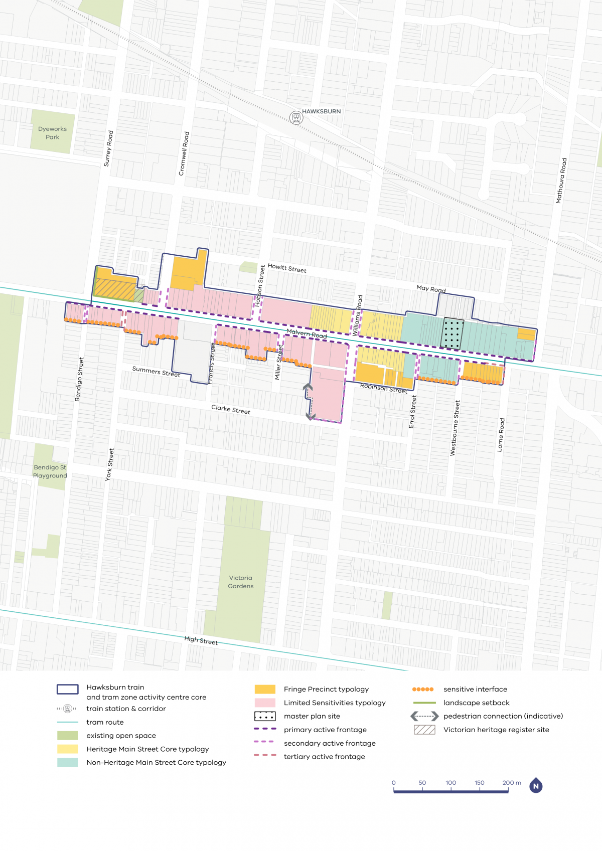
- applied active frontages along Malvern Road and on side streets, to maintain and enhance the vibrancy of Hawksburn’s commercial and retail activity
- applied six storey building heights on the fine grain heritage shop fronts around the intersection of Malvern and Williams Road, and focused greater heights west of Williams Road on larger light industrial sites that better accommodate greater building heights.
- applied moderate protection to Cromwell Park, to ensure the space remains a place that the community loves to spend time in
- designated Malvern Road, Williams Road and select side streets as key pedestrian streets, to ensure sun protection is maintained.
Hawksburn core and catchment map
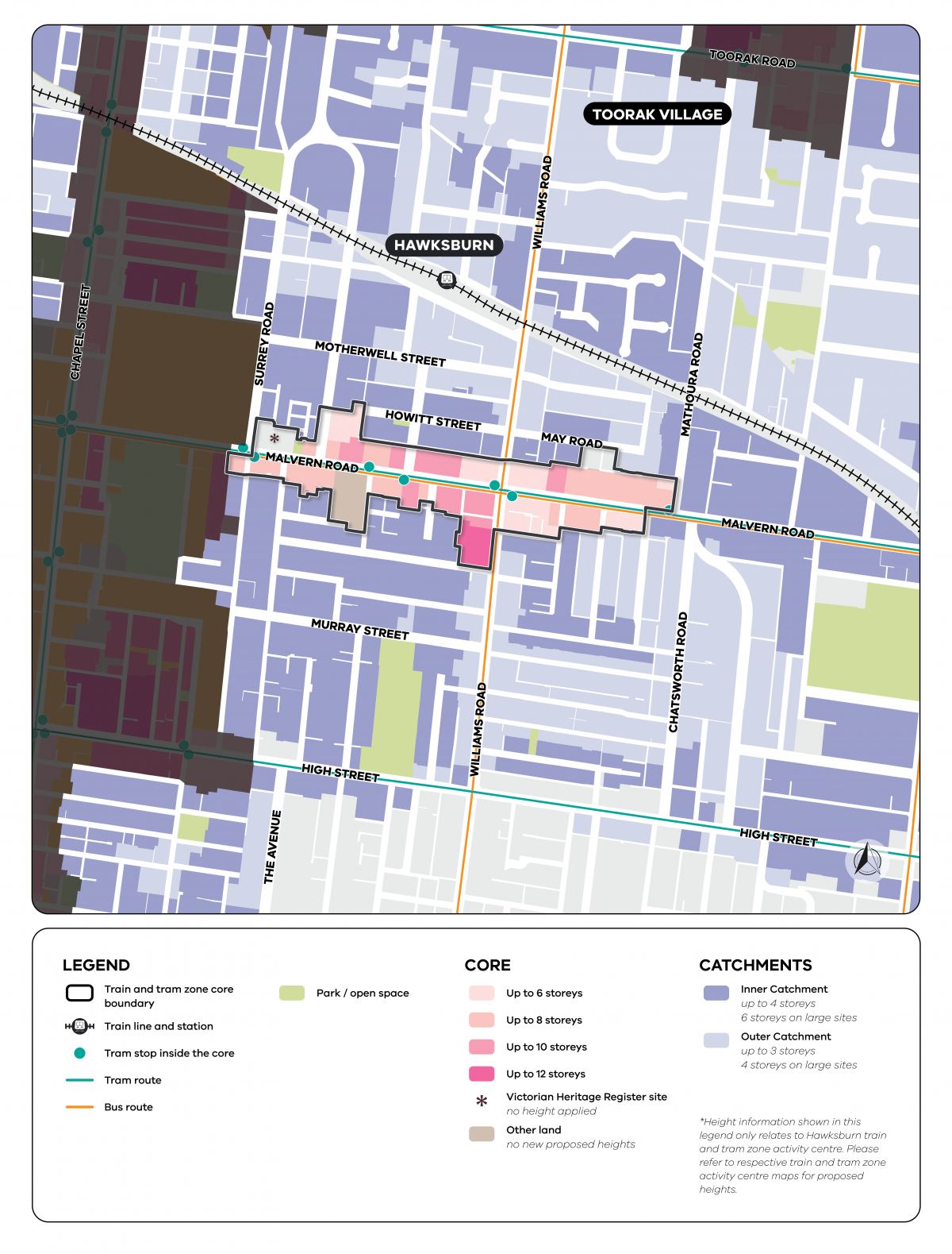
View the Hawksburn to Malvern and Toorak Village core and catchment map.
Hawksburn core and catchment explained
The core is the central part of the train and tram zone activity centre, closest to public transport, jobs and services. This area is best suited to accommodate more homes.
The catchment is the surrounding area within approximately 10 minutes’ walk of the core (around 800 metres).
As you move away from the commercial and community core of the train and tram zone activity centre, we expect that the proposed building heights will gradually decrease. This will allow a transition between the activity centre and the surrounding suburb.
In Hawksburn, the catchment directly intersects with the South Yarra to Windsor catchment. This is reflective of the high access to transport, public services and amenities local residents enjoy.
Visit the How we’re planning page to find out more about core and catchment areas, new planning tools, streamlined planning processes and the approach to delivering more homes in train and tram zone activity centres.
Activity centre plans
The built form outcomes and building heights for the activity centre core are set out on the following plans:
Plan 3: Hawksburn typology, activation and setbacks.
Plan 4: Hawksburn building heights and sun protection.
The plans support the right types of homes being built in the places they fit best.

Page last updated: 14/08/26