
Reference
On this page:
The vision for Armadale
The following vision for the Armadale train and tram zone activity centre is built from the Statement of Advice prepared by a Community Reference Group (CRG) made up of local community members.
High Street’s distinctive mix of eclectic and designer boutiques, fine‑grained heritage buildings, and specialty retail and hospitality services will be strengthened by new developments integrating old and new built forms. Strategic infill development will be carefully designed to protect the centre’s celebrated high street character and heritage fabric.
"I’d love to see higher density homes but to be consistent with neighbourhood appeal so local charm, vegetation and sun is not lost."
What we understand about the place and how we’ve addressed it
High Street, Armadale is distinguished by its commercial vibrancy, diverse boutique offerings – including fashion, galleries and intimate hospitality venues, low commercial vacancy and intact heritage buildings.
The Community Reference Group highlighted the importance of Heritage Overlays in shaping where taller development should occur.
We heard that the community is generally supportive of concentrating greater height along main roads, and near the train station, provided this is done in a way that respects local character, existing greenery, the established streetscape and residential areas immediately behind and to the south of High Street.
As part of our work, we've:
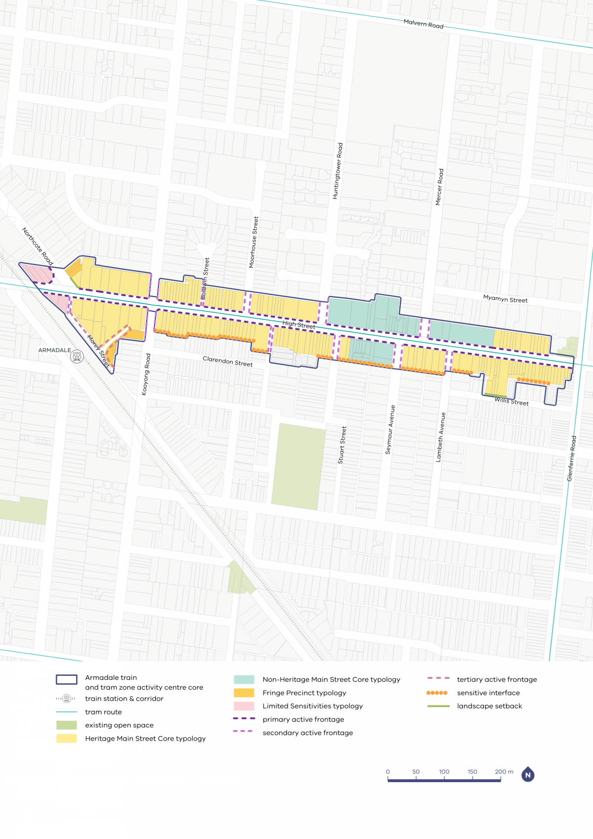
- applied heritage main street typology predominantly along High Street, to preserve the heritage streetscape values
- applied active frontages along High Street to promote commercial and retail uses at ground level and encourage a vibrant street life
- applied sensitive interfaces controls to protect the amenity of the residential properties to the south of High Street
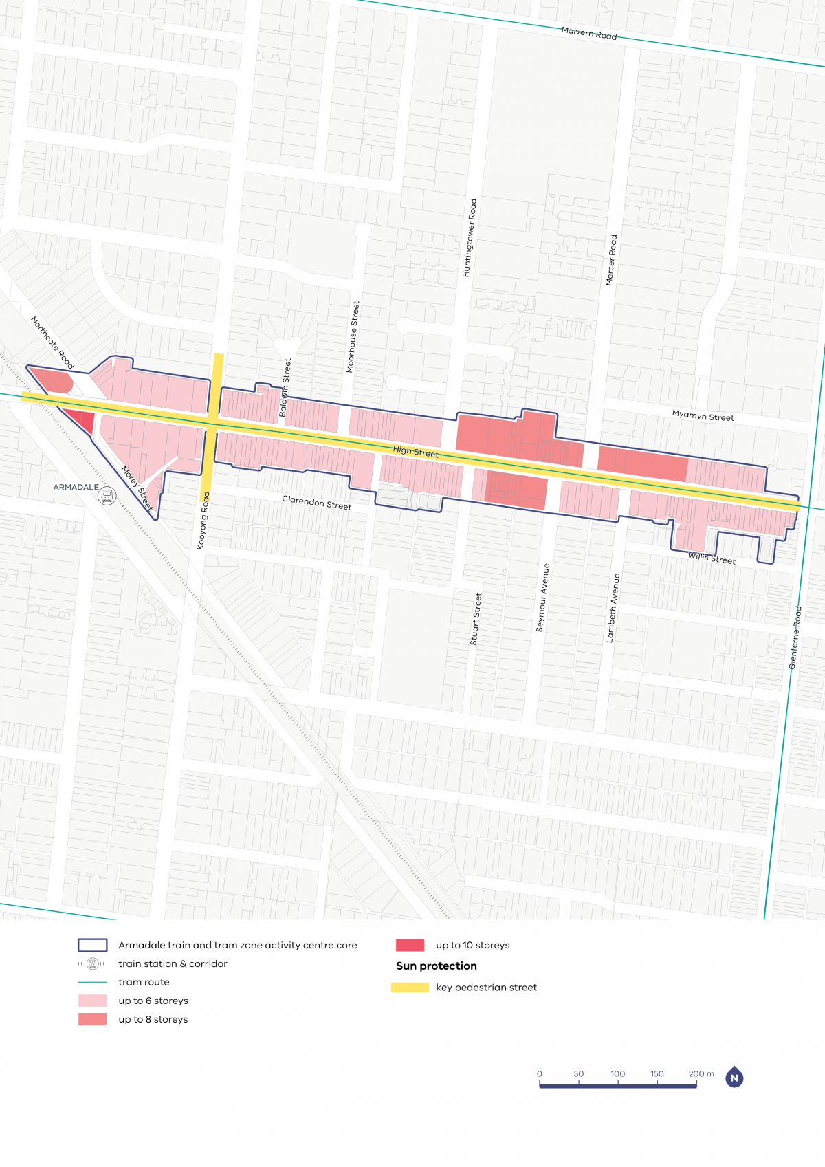
- applied modest building heights of up to six storeys across most of High Street to support shop-top housing while maintaining good solar access at the street level
- designated High Street and Kooyong Road as key pedestrian streets with higher sun protection, recognising the important retail and commercial activity present.
Armadale core and catchment map
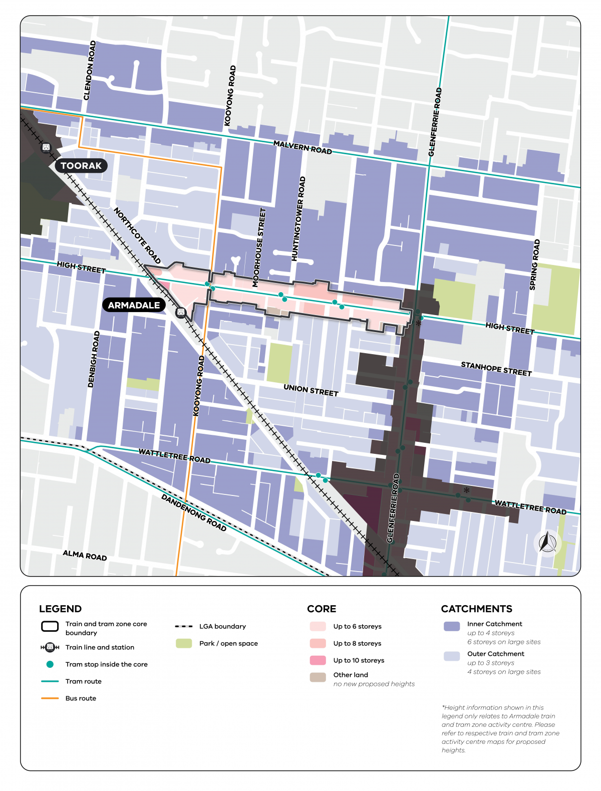
View the Hawksburn to Malvern and Toorak Village core and catchment map.
Armadale core and catchment explained
The core is the central part of the train and tram zone activity centre, closest to public transport, jobs and services. This area is best suited to accommodate more homes.
The catchment is the surrounding area within approximately 10 minutes’ walk of the core (around 800 metres).
As you move away from the commercial and community core of the train and tram zone activity centre, we expect that the building heights will gradually decrease. This will allow a transition between the activity centre and the surrounding suburb.
In Armadale, we have applied outer catchment in areas that have large heritage precincts and reduced public transport access such as the area west of Glenferrie Road.
Visit the How we’re planning page to find out more about core and catchment areas, new planning tools, streamlined planning processes and the approach to delivering more homes in train and tram zone activity centres.
Activity centre plans
The built form outcomes and building heights for the activity centre core are set out on the following plans:
Plan 7: Armadale typology, activation and setbacks.
Plan 8: Armadale building heights and sun protection.
The plans support the right types of homes being built in the places they fit best.
Page last updated: 14/08/26