
Reference
On this page:
The vision for Ashburton
The following vision for the Ashburton train and tram zone activity centre is built from the Statement of Advice prepared by a Community Reference Group (CRG) made up of local community members, as well as Boroondara Council’s strategic work and engagement.
Ashburton will remain a vibrant and friendly centre, where its rich history is enjoyed by locals and visitors alike, who benefit from the convenient access to shops, cafes, services and community facilities.
New homes and infrastructure will be carefully planned to enhance the area’s character and values, with existing heritage being protected and celebrated in all future development. Greener, tree-lined streets and community spaces will support environmental sustainability and community wellbeing.
"I would like to see more apartment buildings and townhouses built, but with family‑friendly proportions. Many people enjoy the parks and wide open spaces of Ashburton, while being close to amenities."
What we understand about the place and how we’ve addressed it
High Street is known for its lively and bright atmosphere, where residents and visitors spend time with friends and family, enjoying all it has to offer.
The Community Reference Group noted how important the village character and charm are for Ashburton.
We heard that the community is generally supportive of new development being focused along High Street.
As part of our work, we've:
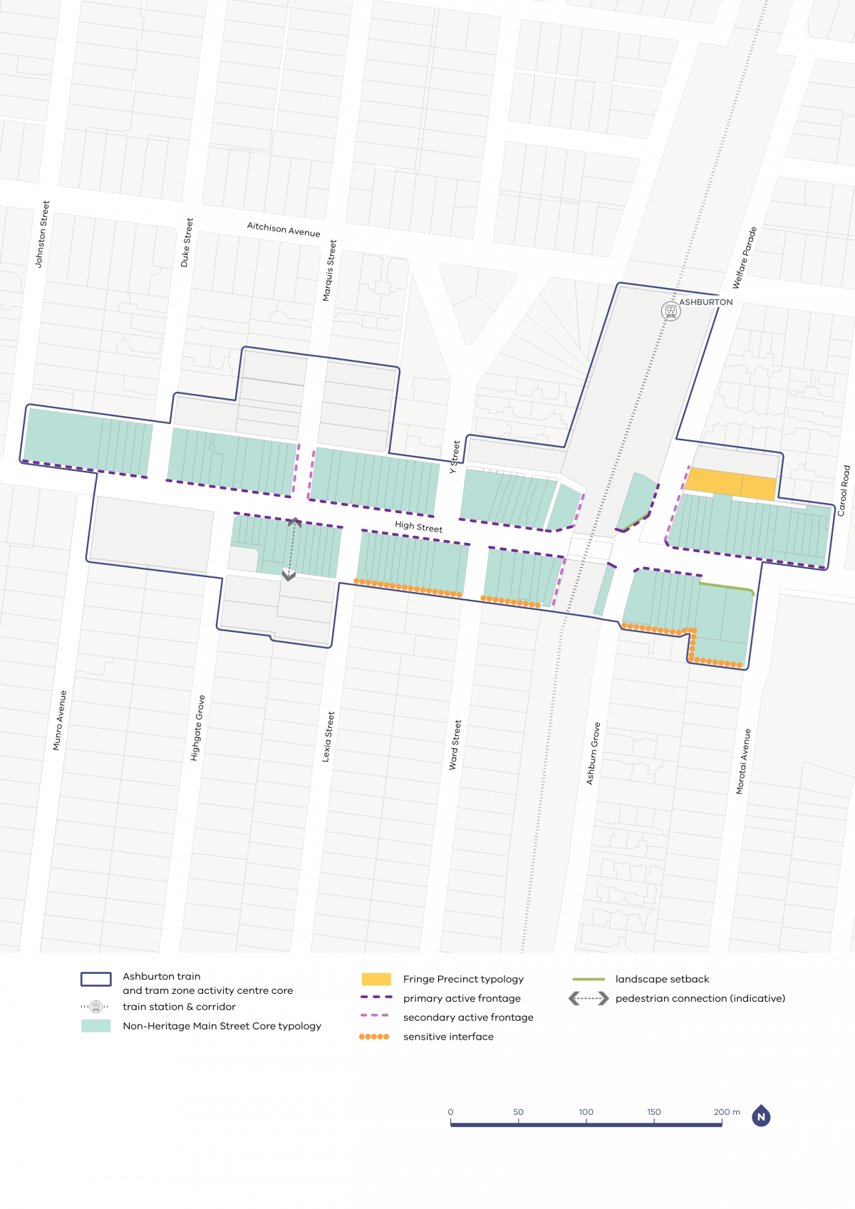
- applied primary active frontages along High Street, to ensure a high level of vibrancy is retained and to support further opportunities for activation
- applied the Non-Heritage Main Street Core typology to all of High Street, to retain the main street feel
- applied landscape setbacks to protect existing canopy trees, supporting a greener, cooler High Street
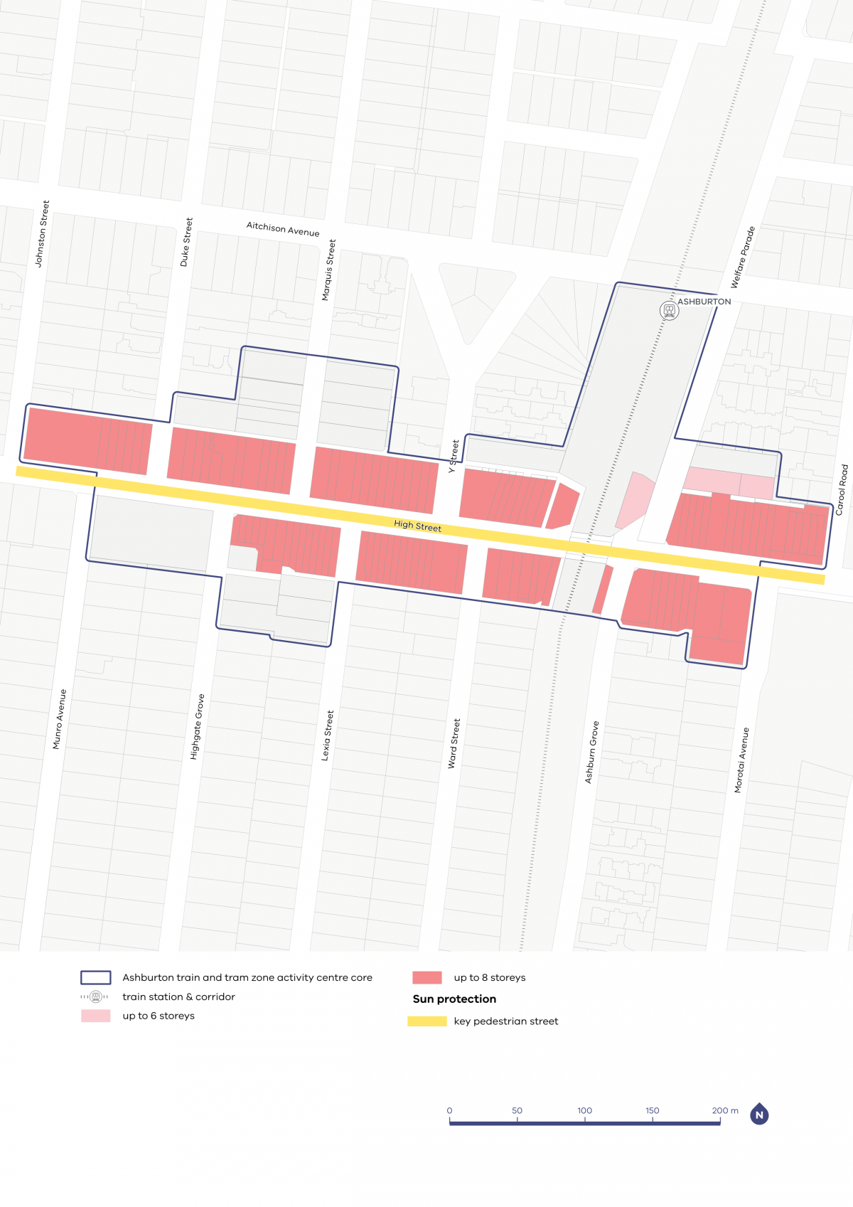
- identified High Street as a key pedestrian street to protect sun access to footpaths and encourage people to spend time here.
Ashburton core and catchment map
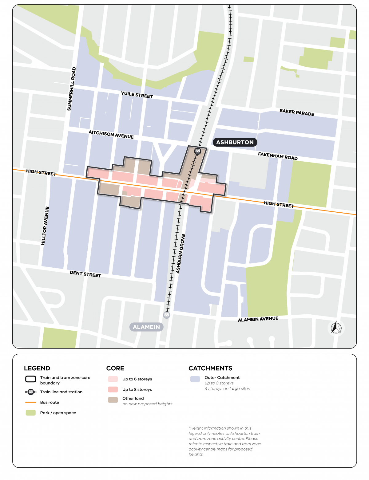
View the Ashburton core and catchment map.
Ashburton core and catchment explained
The core is the central part of the train and tram zone activity centre, closest to public transport, jobs and services. This area is best suited to accommodate more homes.
The catchment is the surrounding area within approximately 10 minutes’ walk of the core (around 800 metres).
As you move away from the commercial and community core of Ashburton, we expect that the proposed building heights will gradually decrease. This will allow a transition between the activity centre and the surrounding suburb.
In Ashburton, the catchment boundary is based on pedestrian accessibility to Ashburton Station and the commercial core of High Street.
Areas of open space such as the Ferndale Trail, Ashburton Park and Warner Reserve bound the catchment to the north and east, acting as natural breaks to the catchment extent.
Visit the How we’re planning page to find out more about core and catchment areas, new planning tools, streamlined planning processes and the approach to delivering more homes in train and tram zone activity centres.
Activity centre plans
The built form outcomes and building heights for the activity centre core are set out on the following plans:
Plan 3: Ashburton typology, activation and setbacks.
Plan 4: Ashburton building heights and sun protection.
The plans support the right types of homes being built in the places they fit best.
Page last updated: 02/10/26